
View Barnstable eWeekly HERE
ROADS
eWeekly May 18, 2018
View Barnstable eWeekly HERE
May 17, 2018 Town Council Meeting
eWeekly May 11, 2018
View Barnstable eWeekly HERE
Clean up Cotuit Saturday
Join the Cotuit-Santuit Civic Association
Help Clean-Up the Village
Meet at Lowell Park SATURDAY MAY 12, 2018, 10am
Safety Vests, Gloves, Bags & Refreshments Provided
(Rain date May 19)
Thank you for taking pride in your community

eWeekly May 4, 2018
View Barnstable eWeekly HERE
Sagamore Bridge Work Update
The Sagamore Bridge is Open!
The repair work on the Sagamore Bridge is nearly complete. The contractor is now off the bridge and all four travel lanes are open. In the next few days the contractor will continue to perform off-roadway work and removal of signage. More information from the US Army Corps of Engineers HERE

Live Traffic Information HERE
May Barnstable Bulletin
View May Barnstable Bulletin HERE
eWeekly April 27, 2018
View Barnstable eWeekly HERE
eWeekly April 20, 2018
View Barnstable eWeekly HERE
Attention Drivers


eWeekly April 13, 2018
View Barnstable eWeekly HERE
ROAD WORK NOTICE
Town of Barnstable DPW- Drainage Improvements
The Department of Public Works is performing drainage improvements on Mariner Circle, Cotuit. Work will begin Monday, April 9, 2018 and will continue as weather allows. Motorists and pedestrians may be redirected around the construction operations when necessary. Both motorists and pedestrians are advised to seek alternate routes to avoid the construction work. Construction operations will start promptly at 7:00 AM and run until 5:00 PM Monday through Friday.
eWeekly April 7, 2018
View Barnstable eWeekly HERE
April Barnstable Bulletin
View HERE
eWeekly March 30, 2018
View Barnstable eWeekly HERE
eWeekly March 23, 2018
View Barnstable eWeekly HERE
Weather Related Cancellations, Delays & Closings
View listing HERE
WINTER WEATHER ADVISORY
URGENT – WINTER WEATHER MESSAGE National Weather Service Taunton MA 9:23 PM EDT Tue Mar 20 2018
…WINTER WEATHER ADVISORY WEDNESDAY 3/21/18 5pm THROUGH THURSDAY 3/22/18 MORNING…
* WHAT… Wet snow. Total snow accumulations will range from 3 to 5 inches on the upper Cape, Martha`s Vineyard, and Block Island, to as little as 1 to 2 inches on the outer Cape.
* WINDS…Northeast 20 to 30 mph with gusts up to 60 mph with the strongest winds Wednesday night into Thursday morning.
* WHERE…Cape Cod and the Islands.
* WHEN…From Wednesday morning through Thursday morning.
* ADDITIONAL DETAILS…Plan on difficult travel conditions. Tree branches could fall. Significant reductions in visibility are possible.
VIEW FORECAST HERE
eWeekly March 16, 2018
View Barnstable eWeekly HERE
Weather Related Cancellations, Delays & Closings
View listing HERE
Town of Barnstable & Public Works Updates
For downed trees, please call the Highway Department 508-790-6330
March 14, 2018 08:00 AM Town of Barnstable Employees: Town offices are open today subject to power outages. At this time Town Hall, Police Station, DPW Facilities, 200 Main Street, MEA Building, and Senior Center have power. Please check with your manager as to the status of the facility at which you work. For the Public: Please check with the department you wish to conduct business with as to its status of operation before visiting the facility.
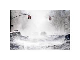
March 13, 2018 9:30 PM We apologize for the break in coverage on the Storm Alerts. Power outages prevented us from regularly updating the website. Crews have been out all day plowing and removing trees and we expect to be at it into the early morning hours tomorrow. There are still a large number of trees that are down and blocking roads (we have had over 200 trees reported down today), many of which are tangled in wires. Please use extreme caution when moving around the Town.
March 13, 2018 3:00 PM Though the snow accumulations have not been as dire as expected, the winds and weight of the snow is taking its toll. To date we have over 185 trees down across Town, many with wires associated with them. We also have a large number of utility poles that have been broken. As a result, the Town is experiencing extensive power losses. Street lights and traffic lights are not working in many locations. In addition to the plow crews, we have four tree crews working to make roads passable. However, please do not leave where you are unless you absolutely need to do so.As always, please follow the advice of public safety officials. Be safe!
March 13, 2018 09:30 AM – We are experiencing heavy snows and high winds. All crews are out plowing. Additionally, we have had over 30 tree calls already this morning, with more coming all the time, so have three tree crews deployed to address them. Driving conditions are treacherous, and many roads have impediments to travel due to the downed trees or downed wires. Please remain where you are if at all possible.
March 13, 2018 05:30 AM – Good morning, winter storm Skylar has begun. Roads are already coated with snow, and forecasts are for significant snowfall (multiple inches per hour) throughout the morning and early afternoon. Winds are also going to be gusting making drifting an issue. DPW is already out salting main roads, and will soon be plowing main and secondary roads. If the predicted rate of snow materialize, it is very likely we will be struggling to keep up until the storm moderates, and drifting will exasperate that situation. As a result, it is likely roads will become snow filled between plow passes, and driving will be difficult. Please stay off the roads if at all possible. It would also be very helpful if you do go out if you could refrain from parking on the main streets of Hyannis, Barnstable and Osterville villages. Please also be aware that secondary roads will only initially be plowed to allow access, and will be “cleaned up” toward the end of the storm when snowfall rates decline.
March 13, 2018 05:00 AM – Due to the impending storm, Town Manager Mark Ells has said that Town of Barnstable municipal buildings will be closed today, Tuesday, March 13th. All non-essential personnel will be off today. If you have any questions as to whether you are considered essential or non-essential for this particular type of storm, please contact your direct supervisor.
March 13, 2018 05:00 AM – Due to the storm, the Transfer Station at 45 Flint Street, Marstons Mills, will be closed on Tuesday, March 13, 2018
Blizzard Warning

 …BLIZZARD WARNING IN EFFECT FROM 11 PM THIS EVENING TO 8 PM EDT TUESDAY…
* WHAT…Blizzard conditions expected. Winds gusting as high as 65
mph will cause whiteout conditions in blowing snow. Significant
drifting of the snow is likely. Total snow accumulations of 10
to 18 inches with localized 20 inch amounts possible.
* WHERE…Coastal Essex County, Plymouth County, Cape Cod and
Marthas Vineyard.
* WHEN…From 11 PM this evening to 8 PM EDT Tuesday.
* ADDITIONAL DETAILS…Travel will be very dangerous with 1 to 3
inch per hour snowfall rates at times and significantly impact
the morning commute. The Tuesday afternoon commute is also
expected to be impacted. Wet snow and strong winds will result
in some power outages and tree damage.

eWeekly March 9, 2018
View Barnstable eWeekly HERE
eWeekly March 2, 2018
View Barnstable eWeekly HERE
eWeekly February 23, 2018
View Barnstable eWeekly HERE
eWeekly February 16, 2018
View Barnstable eWeekly HERE
eWeekly February 9, 2018
View Barnstable eWeekly HERE
eWeekly February 2 , 2018
View Barnstable eWeekly HERE
Weather Related Cancellations, Delays & Closings

View listing HERE
Winter Weather & Wind Advisory
Remains in Effect until January 30, 1 pm
View Weather Forecast Here
Barnstable eWeekly January 26, 2018
Formerly Town Manager’s Newsletter
View eWeekly HERE
Barnstable eWeekly January 19, 2018
View eWeekly HERE
Announcement Regarding Temporary Signs

Winter Weather Advisory
Weather Forecast Here
Barnstable eWeekly January 12, 2018
Formerly Town Manager’s Newsletter
View eWeekly HERE
Barnstable eWeekly January 5, 2018
Formerly Town Manager’s Newsletter
View eWeekly HERE
Winter Storm Grayson
DPW STORM UPDATE!
January 4, 2018 10:30 PM – The bulk of the snow has ended. We have begun final salting of the main roads. Once that has been completed we will begin salting secondary roads. We expect that to be completed at approximately 4:00 AM. Temperatures are dropping, so walks and areas that do not have salt on them will be slick. If you go out, please be cautious.
January 4, 2018 7:30 PM – We still are experiencing bands of snow coming through, and as a result are continuing to scrape and salt the main roads. Secondary road plow drivers are on their routes as well. Once the snow stops falling, crews will finish scraping and apply an application of salt on all roads (mains and secondary roads), and parking lots. Please be aware, temperatures have dropped below freezing and with all of the moisture we received there is a lot of ice on walks and roads. If you must go out, please proceed with caution.
January 4, 2018 2:00 PM – The rain has started to turn to snow. Western portions of the Town are reporting heavy slush on the roads, and the eastern portions are starting to shush up as well. We are dispatching the main road plows and spreaders to start to scrape off the slush and get a layer of salt down. Secondary road contractors have been called in, and should be on their routes in an hour or so. We have also experienced flooding in coastal areas on the north side of town due to the high tides and wind pushing water on shore. If you must travel, please be aware that as temperatures continue to drop all of the moisture on the roads will freeze and driving will become hazardous.
January 4, 2018 08:15 AM – Good morning, our first large storm of the season is at our doorstep. “Grayson”, as named, is predicted to bring us rain through mid-day, then transition to a mix, and finally become just snow. Depending on the forecast you listen to, snow totals are predicted from less than an inch to up to 4-8 inches. As a result, the DPW is preparing for the higher amounts, and will adjust if get the lesser totals. Spreaders are on site standing by to address icing, and main road plows will be on station starting at 10AM in the event of an early turn-over. Tree crews are also ready in the event that the predicted winds cause tree damage. Finally we are monitoring for possible flooding due to rain falling on frozen ground, and the timing of high tides. At this point we just need to wait to see what Mother Nature send us. All forecasts are predicting that driving conditions this afternoon will be poor, so please stay in if possible.
As a reminder, the Transfer Station will be closing at noon, or sooner if the winds intensify faster than predicted.
Track Snow Fleet HERE
Weather Related Cancellations, Delays & Closings
View listing HERE
WINTER STORM WARNING!
URGENT - WINTER WEATHER MESSAGE
National Weather Service Taunton MA
1022 PM EST Wed Jan 3 2018

MAZ022-023-041130-
/O.CON.KBOX.WS.W.0001.180104T1500Z-180105T0600Z/
Barnstable MA-Dukes MA-
Including the cities of Chatham, Falmouth, Provincetown,
and Vineyard Haven
1022 PM EST Wed Jan 3 2018

...WINTER STORM WARNING REMAINS IN EFFECT FROM 10 AM THURSDAY TO
1 AM EST FRIDAY...

* WHAT...Heavy snow expected. Plan on difficult travel conditions.
  Expect damage to trees and power lines as well. Total snow
  accumulations of 2 to 6 inches are expected.

* WHERE...Cape Cod and Marthas Vineyard.

* WHEN...From 10 AM Thursday to 1 AM EST Friday.

* ADDITIONAL DETAILS...High Wind Warning is also in effect for
  gusts as high as 60 to 70 mph. There should be an hour or two
  where whiteout conditions occur. Be prepared for significant
  reductions in visibility at times.

PRECAUTIONARY/PREPAREDNESS ACTIONS...

A Winter Storm Warning for snow means severe winter weather
conditions are expected. If you must travel, keep an extra
flashlight, food and water in your vehicle in case of an
emergency. The latest road conditions for the state you are
calling from can be obtained by calling 5 1 1.
VIEW FORECAST HERE
Weather Advisory

…WINTER WEATHER ADVISORY IN EFFECT FROM NOON SATURDAY TO 1 AM
EST SUNDAY…
* WHAT…Snow expected. Plan on slippery road conditions. Total
snow accumulations of 2 to 4 inches are expected.
* WHERE…Barnstable MA County.
* WHEN…From noon Saturday to 1 AM EST Sunday.
* ADDITIONAL DETAILS…Be prepared for reduced visibilities at
times.
PRECAUTIONARY/PREPAREDNESS ACTIONS…
A Winter Weather Advisory for snow means periods of snow will
cause primarily travel difficulties. Be prepared for snow covered
roads and limited visibilities, and use caution while driving.
The latest road conditions for the state you are calling from can
be obtained by calling 5 1 1. Weather HERE

You must be logged in to post a comment.