
View Power Outage Map & Report HER
Stay Safe!

Be Aware Deer Hunting Shotgun Season Begins Today!
November 27-December 9, 2023

View Regulations HERE
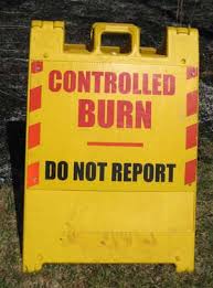
Prescribed burns planned for Camp Edwards
September 21 and September 22, conditions permitting
The Massachusetts National Guard’s Natural Resources Program plans to conduct prescribed burns on Camp Edwards on Joint Base Cape Cod today, Thursday, September 21, and Friday, September 22. The primary objectives of the prescribed burns are wildland fuel hazard reduction, ecological pine barrens/grasslands management, and wildland firefighter training.
Questions may be directed to Emily Kelly, Community Involvement Specialist, at 339-202-9341, or Jake McCumber, Natural Resources Manager, at 339-202-9343.
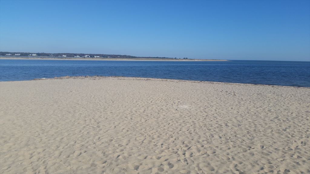
Attention Swimmers
Cotuit Loop Beach
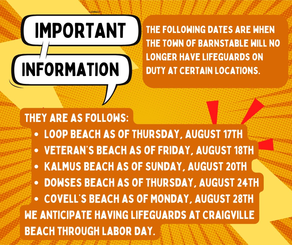
The Town of Barnstable Recreation will begin reducing staffing at certain beach locations as employees head back to school and other obligations. Recreation will not have lifeguard staff at Loop Beach after Wednesday August 16th. There will be gate staff, and appropriate signage.


 UPDATE: AUGUST 11, 2023
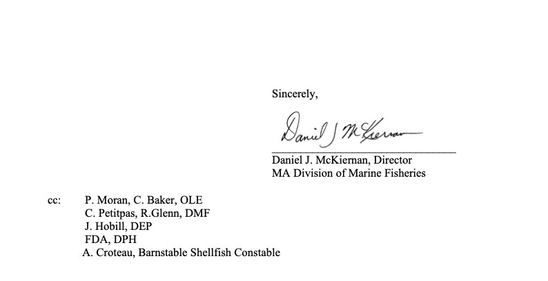
Barnstable Harbor, Cotuit Bay and West Bay are all cleared to re-open to shellfishing effective sunrise tomorrow 08/12/2023.
These areas will revert to the open/closed maps from before the emergency closure meaning that any areas within these water bodies that were closed prior to the emergency closure, remain closed.
Shellfish open and closed area maps should be updated by tomorrow morning to show the most up to date maps, you can view them HERE and HERE
Be sure to check the maps tomorrow before the afternoon tide to ensure you are headed out to an open area as all of Hyannis and Poponessett Bay remain CLOSED until further notice.
Take Care,
Amy Croteau
Any questions please call the Division of Marine Fisheries at 978-282-0308.

Fireworks July 1, 2023 9pm Cotuit Inner Harbor

Sponsored by the Oyster Harbors Club
Open Burning Season begins January 15 – May 1 between the hours of 10-4. Permits are not required however you must call the Cotuit Fire Department (508) 428-2210 on the morning you wish to burn after 9:30am.

MassDEP answers to your burning questions HERE
Barnstable County Department of Health and Environment to Host Three Public Vaccine Clinics in September and October
Clinics will provide an opportunity to get the recently approved COVID-19 bivalent booster, and/or the influenza vaccine for the 2022/2023 flu season
September 8, 2022 (Barnstable, MA) – Barnstable County Department of Health and Environment’s Public Health Nursing Division will be offering three public vaccine clinics for administration of both the COVID-19 bivalent booster (or “updated booster”) and/or the 2022/2023 influenza vaccine. The clinics will be held at the Harborview Conference Room at 3195 Main Street in Barnstable Village at the following dates and times:
September 21, 2022, 9:00 AM to 12:00 PM
September 30, 2022, 9:00 AM to 12: 00 PM
October 5, 2022, 12:00 PM to 3:00 PM
Accommodations will be provided for those with impaired mobility.
Participants must be 18 years of age or older and can pre-register for a Pfizer or Moderna bivalent booster and/or influenza vaccine at the following link:
https://home.color.com/vaccine/register/barnstable?calendar=53d670fc-9ea3-4720-8b22-15be78562f8d. Anyone who requires telephone assistance to register for these clinics may call the COVID-19 Helpline at (774) 330-3001.
We are unable to accept walk-ins and will not administer vaccine to anyone who does not have an appointment. Participants should arrive no more than 10 minutes prior to their scheduled time to prevent lines and long wait times.
Homebound individuals who would like to receive an updated COVID-19 booster can call the Visiting Nurses Association (VNA) at (508) 957-7737 to schedule a visit.
Like the flu vaccine, the updated COVID-19 boosters are bivalent, meaning they protect against two different viruses or two strains of the same virus. In this case, the boosters target the original COVID-19 strain and the newer omicron variant. Reported side effects are the same as the original vaccine. It is safe and effective to receive the updated booster and the flu vaccine simultaneously, or patients may choose to receive them on separate dates.
It is important to note that the original monovalent Pfizer and Moderna mRNA COVID-19 vaccines are no longer authorized for use as boosters in people ages 12 years and older. The FDA made this decision because the updated booster is designed to offer more protection from the circulating omicron variant.
For vaccination and booster schedules by vaccine manufacturer, visit CDC’s website at https://www.cdc.gov/coronavirus/2019-ncov/vaccines/different-vaccines.html. For information on vaccination and booster shots in Barnstable County visit Vaccine Information – Barnstable County (capecod.gov). You may also find and schedule vaccination appointments at local pharmacies and community health clinics through https://vaxfinder.mass.gov.
ABOUT BARNSTABLE COUNTY DERPARTMENT OF HEALTH AND ENVIRONMENT
Established under a Special Act of the Legislature in 1926, the Barnstable County Department of Health & Environment (BCDHE) provides regional public health and environmental health services throughout the 15 towns comprising Barnstable County. The Department manages several environmental, public health, and homeland security grants funded through state and federal resources. The Department’s primary mission is to protect public health and the environment and promote the physical and mental health and well-being of Barnstable County residents.
ABOUT BARNSTABLE COUNTY REGIONAL GOVERNMENT OF CAPE COD: Barnstable County provides exemplary government functions and services to keep our community healthy and safe, promote sustainable growth, and offer a proactive, open government that enhances the quality of life for the citizens of Barnstable County. Learn more at https://www.capecod.gov/
MEDIA CONTACT: Bethany Traverse, Health Communications Coordinator, bethany.traverse@barnstablecounty.org

Attention Swimmers
Cotuit Loop Beach
Thursday August 18, 2022
8:30 AM
Public Beach Re-Opens
August 16, 2022 – Loop Beach continues to remain closed for swimming due to elevated Enterococci bacteria counts. Due to this exceedance, this beach does not meet 105 CMR 445.00, Minimum Standards for Bathing Beaches, and is required to be closed to swimming. Re-samples were taken today and the results will be available late tomorrow afternoon.
Beach Water Quality Updates August 15, 2022 Loop Beach continues to remain closed for swimming due to elevated Enterococci bacteria counts. Due to recurring bacterial count exceedances, this beach does not meet 105 CMR 445.00, Minimum Standards for Bathing Beaches, and is required to remain closed to swimming. Re-samples are being taken today however due to the geomean exceedance levels results observed during the past multiple days, please be advised that this beach may be required to remain closed for several more days.August 12, 2022 –
Loop Beach continues to remain closed for swimming due to elevated Enterococci bacteria counts. Due to this exceedance, this beach does not meet 105 CMR 445.00, Minimum Standards for Bathing Beaches, and is required to be closed to swimming.
Re-samples are being conducted, however due to the exceedance levels, the beach will remain closed for a minimum of this weekend.
David W. Stanton, RS
Chief Health Inspector
August 10, 2022 – 3pm Loop Beach is closed for swimming due to elevated Enterococci bacteria counts. Due to this exceedance, this beach does not meet 105 CMR 445.00, Minimum Standards for Bathing Beaches, and is required to be closed to swimming.
Re-samples were collected yesterday and the results of the re-samples will be available late this afternoon.
David W. Stanton, RS
Chief Health Inspector
Attention Swimmers
Cotuit Loop Beach
Per Town of Barnstable Director of Recreation, DPW rakes the beach to the high tide mark once a week. The rake will scoop up trash and seaweed to the high tide mark. Anything below that mark gets left behind for mother nature to take care of. Staff picks up trash on the beach every morning but doesn’t have the capability of doing the seaweed.
The last day of lifeguards at Loop Beach will be August 6th. On August 7th, there will still be a Gate Attendant to check stickers and open the bathroom. Loop will be staffed in that capacity for as long as they can.
Fireworks July 3, 2022, 9pm Cotuit Inner Harbor
hosted by the Oyster Harbors Club
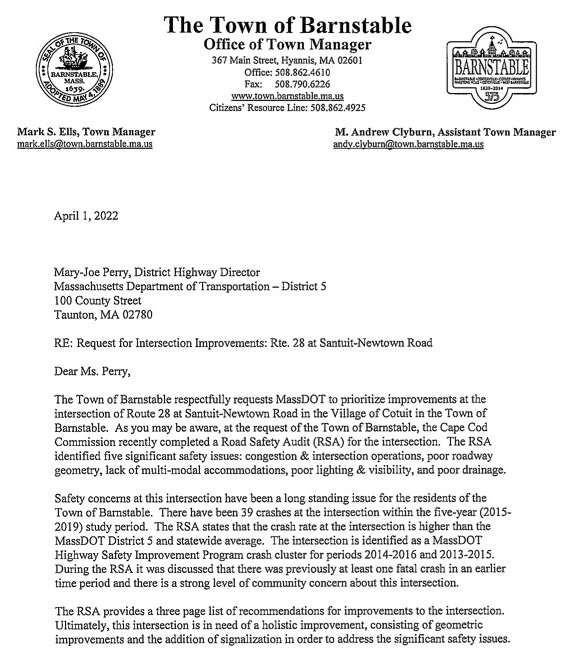
Update: 6/21/22
Copy of letter sent to Mark Ells by MassDOT
“Mark S. Ells
Town Manager Town of Barnstable 367 Main St. Hyannis, MA 02601
June 14, 2022
Subject: MassDOT Highway Division Project 612776 BARNSTABLE – INTERSECTION IMPROVEMENTS AT ROUTE 28 (FALMOUTH ROAD) AND SANTUIT-NEWTOWN ROAD- Project Eligibility Notification
Dear Mr. Ells:Please be advised that the Highway Division’s Project Review Committee (PRC) has approved a project in the Town of BARNSTABLE – INTERSECTION IMPROVEMENTS AT ROUTE 28 (FALMOUTH ROAD) AND SANTUIT-NEWTOWN ROAD and assigned it the project number 612776. MassDOT will now begin the project development process for this project. As the project develops, MassDOT will coordinate with the town to determine priorities and potential phasing depending on the availability of funds.
PRC approval is not a commitment of state or federal funding to the project. MassDOT, in conjunction with the Cape Cod Commission, continually evaluates transportation needs and priorities. MassDOT is responsible for the design, permitting, and documentation required to complete the project through construction.
District 5 will keep you informed of the project’s progress and will involve you in any key decisions related to the project scope, any right-of-way impacts, possible environmental concerns, traffic management plans, or anything else warranted.
You may monitor this project’s progress through the MassDOT web site at
https://hwy.massdot.state.ma.us/projectinfo/projectinfo.asp
District 5, 1000 County Street, Taunton, MA 02780 Tel: 857-368-5000, Fax: 508-880-6102 http://www.mass.gov/massdot”
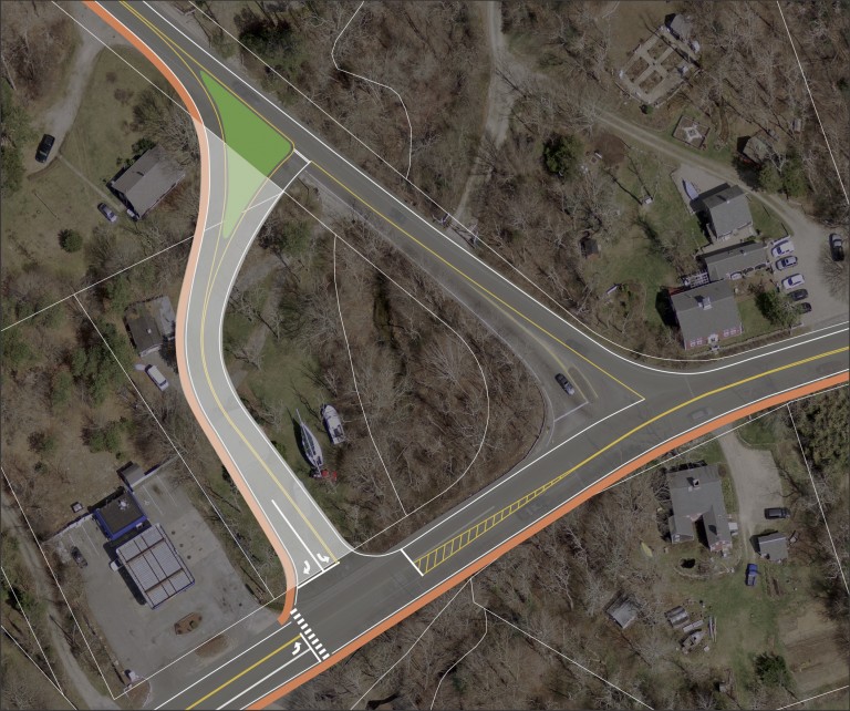
Update: 6/1/22
Sharing the good news that MassDOT approved a new project for Route 28 at Santuit Newtown Road earlier this month at their PRC meeting. MassDOT initiated an intersection improvement project for this intersection at the Project Review Committee (PRC) meeting held on May 12, 2022. This is the first step necessary for a project to develop through the TIP process for design and construction. The project was approved through PRC. The design process can now begin.
MassDOT looks forward to working with the Town as this project progresses!

Update: 4/1/22
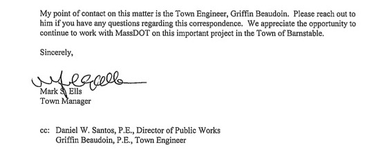
Update: 3/2/2022
View Final Route 28 at Santuit-Newtown Road Safety Audit HERE
JUST INFORMED THIS IS NOT A PUBLIC MEETING!
Virtual Road Safety Audit (RSA) on Thursday, December 9, 2021 from 1:00 PM to 4:00 PM for the intersection of Route 28 at Santuit-Newtown Road.
UPDATE: 11/23/21
Road Safety Audit Review Prompt List
The Safety Review Prompt List provides basic safety-related questions to use when evaluating a given roadway location. The prompt list should be considered when evaluating a roadway to design improve- ments or conduct a Road Safety Audit. The primary purpose of the prompt list is to identify potential road safety hazards. The list is meant to be general and should be used to prompt an evaluator as to specific matters identified in the field that may have an adverse effect on road safety. The Safety Review Prompt List is not a check of compliance with design standards.
This Prompt List represents the minimum that should be considered when exploring safety opportunities and is not intended to address all aspects of safety.
A summary of the responses should be prepared to highlight potential safety improvement opportunities.
Speed
Are posted speed limits consistent with speed regulations; are they adequate?
Are design features consistent with the posted speed (passing opportunities, sight distance,
warning signs for horizontal and vertical curves, clearance intervals, sign placement, etc.) Are adequate controls in place for driver compliance with speed limits?
Multi-modal
Have accommodations been provided for safe movement of pedestrians, bicycles, emergency vehicles, public transportation, and commercial vehicles?
What design features could be improved, added, or removed to enhance the safe mobility of the various modes?
Pavement Markings
Are there highly visible and retro reflective edge lines, center lines, and other pavement markings?
Do the pavement markings provide sufficient guidance to the road users? Can the placement of the pavement markings be modified to improve guidance to road users?
Signs
Are all signs retro reflective and visible for all roadway conditions, including placed free from obstructions?
Are signs located to maximize perception and reaction while minimizing intrusion in clear zones? Does the signage provide adequate guidance to road users for given road conditions?
Are pavement markings and signs consistent in effectively guiding road users?
Intersection Control
Do all signs (stop signs, lane assignments, street names, etc.) provide visible, clear, non-conflicting messages?
Is there clear, non-conflicting visibility of traffic control (signal heads, signs, and markings) from all approach lanes?
Has the potential of misrepresentation of intersection control been considered (at closely spaced intersections or through control that is against expectation)?
For signalized intersections, have the implications on safety been considered for the signal phasing?
Is there a safe means by which all modes can travel through the intersection? Lighting
Is lighting (from headlights and/or streetlights) adequate for specific roadway conditions and/or use?
If glare exists from sunlight or opposing headlights, are there countermeasures that can be implemented to minimize potentially detrimental effects?
Obstructions
Are there obstructions to sight lines or roadway guidance (signs, markings, etc.) that can be removed, relocated, or minimized as part of this project?
If obstructions or fixed objects exist but cannot be moved, can they be shielded (with guardrails, etc.) or delineated (with reflectors) to improve road user safety? If so, what can be done?
Pavement
Could the condition of the pavement impact mobility and safety (potholes, edge drop-offs, skid resistance, etc.)?
What improvements can be made to minimize safety impacts?
Access Points and Traffic Generators
Is the access control sufficient for the road’s function?
Are site access points located to maximize safety while still providing adequate access?
Have impacts of site developments been adequately accommodated for safe mobility of all
road users?
Parking
Is parking clearly delineated and in conformance with signs, markings, and regulations? Might parking obstruct mobility/safety of pedestrians and other roadway users?
Weather Conditions
Have accommodations been made for impacts from adverse weather condition (storage of snow, removal of ponding, adequate drainage, signage of low salt areas, maintenance program for snow removal, and catch basin clearing, etc.)?
Auxiliary Lanes
Could taper locations and/or alignments contribute to safety challenges?
Could lack of climbing lanes or passing zones cause driver frustration?
Do acceleration/deceleration lane lengths necessitate additional signage and/or markings?
Animals
Do animal migrations impact safety?
Can measures be taken to reduce animal-vehicle conflicts
The Cape Cod Commission (CCC), in coordination with MassDOT and the Town of Barnstable, have scheduled a Virtual Road Safety Audit (RSA) on Thursday, December 9, 2021 from 1:00 PM to 4:00 PM for the intersection of Route 28 at Santuit-Newtown Road. Your involvement (or a representative from your agency/department) in the RSA is important and will result in specific recommendations for improved safety at this intersection in the village of Cotuit in the Town of Barnstable.
Please find a copy of the agenda and meeting materials RSA Agenda – Rt 28 at Santuit Newtown Rd Dec_2021 Crash Diagram_Santuit_Newtown_Final SantuitNewtown Crash Data Spreadsheet Cotuit_Route_28_Corridor_Study_Final_Report-February_2017(web_version) Please review the crash data, crash diagram and prompt list ahead of time to become familiar with the crash issues and trends. We also encourage you to visit the intersections ahead of the meeting (in person or via Google Street View) if you are not already familiar with the roadway conditions. Additionally, please review the attached Route 28 Cotuit Corridor Study, dated February 2017, which was previously prepared by the Cape Cod Commission Transportation Staff and includes recommendations for this intersection.
Participants in the RSA will discuss crash experience and potential countermeasures for improving safety. Following the meeting, a draft and final report will be prepared by the CCC and distributed to the attendees for review and comment. The final report will guide the Town of Barnstable and MassDOT for potential future short- and long-term safety improvements for this intersection.
The meeting will be held virtually on the Zoom platform. Participants may also dial into the meeting on their phone. See Zoom login details below.
Zoom Meeting Link – https://capecodcommission.org/transportation/join
June 2016
The Cape Cod Commission and the Town of Barnstable will be holding a Public Meeting on the Route 28 corridor from Route 130 to Santuit/Newtown Road.
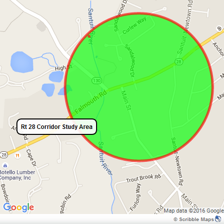
Looking for your valuable input on the study, design and planning process to improve the safety and traffic flow along this congested and unsafe stretch of State Road, Route 28. Cape Cod Commission Project Page
Update: 3/2/2022
View Final Route 28 at Santuit-Newtown Road Safety Audit HERE
JUST INFORMED THIS IS NOT A PUBLIC MEETING!
Virtual Road Safety Audit (RSA) on Thursday, December 9, 2021 from 1:00 PM to 4:00 PM for the intersection of Route 28 at Santuit-Newtown Road.
UPDATE: 11/23/21
Road Safety Audit Review Prompt List
The Safety Review Prompt List provides basic safety-related questions to use when evaluating a given roadway location. The prompt list should be considered when evaluating a roadway to design improve- ments or conduct a Road Safety Audit. The primary purpose of the prompt list is to identify potential road safety hazards. The list is meant to be general and should be used to prompt an evaluator as to specific matters identified in the field that may have an adverse effect on road safety. The Safety Review Prompt List is not a check of compliance with design standards.
This Prompt List represents the minimum that should be considered when exploring safety opportunities and is not intended to address all aspects of safety.
A summary of the responses should be prepared to highlight potential safety improvement opportunities.
Speed
Are posted speed limits consistent with speed regulations; are they adequate?
Are design features consistent with the posted speed (passing opportunities, sight distance,
warning signs for horizontal and vertical curves, clearance intervals, sign placement, etc.) Are adequate controls in place for driver compliance with speed limits?
Multi-modal
Have accommodations been provided for safe movement of pedestrians, bicycles, emergency vehicles, public transportation, and commercial vehicles?
What design features could be improved, added, or removed to enhance the safe mobility of the various modes?
Pavement Markings
Are there highly visible and retro reflective edge lines, center lines, and other pavement markings?
Do the pavement markings provide sufficient guidance to the road users? Can the placement of the pavement markings be modified to improve guidance to road users?
Signs
Are all signs retro reflective and visible for all roadway conditions, including placed free from obstructions?
Are signs located to maximize perception and reaction while minimizing intrusion in clear zones? Does the signage provide adequate guidance to road users for given road conditions?
Are pavement markings and signs consistent in effectively guiding road users?
Intersection Control
Do all signs (stop signs, lane assignments, street names, etc.) provide visible, clear, non-conflicting messages?
Is there clear, non-conflicting visibility of traffic control (signal heads, signs, and markings) from all approach lanes?
Has the potential of misrepresentation of intersection control been considered (at closely spaced intersections or through control that is against expectation)?
For signalized intersections, have the implications on safety been considered for the signal phasing?
Is there a safe means by which all modes can travel through the intersection? Lighting
Is lighting (from headlights and/or streetlights) adequate for specific roadway conditions and/or use?
If glare exists from sunlight or opposing headlights, are there countermeasures that can be implemented to minimize potentially detrimental effects?
Obstructions
Are there obstructions to sight lines or roadway guidance (signs, markings, etc.) that can be removed, relocated, or minimized as part of this project?
If obstructions or fixed objects exist but cannot be moved, can they be shielded (with guardrails, etc.) or delineated (with reflectors) to improve road user safety? If so, what can be done?
Pavement
Could the condition of the pavement impact mobility and safety (potholes, edge drop-offs, skid resistance, etc.)?
What improvements can be made to minimize safety impacts?
Access Points and Traffic Generators
Is the access control sufficient for the road’s function?
Are site access points located to maximize safety while still providing adequate access?
Have impacts of site developments been adequately accommodated for safe mobility of all
road users?
Parking
Is parking clearly delineated and in conformance with signs, markings, and regulations? Might parking obstruct mobility/safety of pedestrians and other roadway users?
Weather Conditions
Have accommodations been made for impacts from adverse weather condition (storage of snow, removal of ponding, adequate drainage, signage of low salt areas, maintenance program for snow removal, and catch basin clearing, etc.)?
Auxiliary Lanes
Could taper locations and/or alignments contribute to safety challenges?
Could lack of climbing lanes or passing zones cause driver frustration?
Do acceleration/deceleration lane lengths necessitate additional signage and/or markings?
Animals
Do animal migrations impact safety?
Can measures be taken to reduce animal-vehicle conflicts
The Cape Cod Commission (CCC), in coordination with MassDOT and the Town of Barnstable, have scheduled a Virtual Road Safety Audit (RSA) on Thursday, December 9, 2021 from 1:00 PM to 4:00 PM for the intersection of Route 28 at Santuit-Newtown Road. Your involvement (or a representative from your agency/department) in the RSA is important and will result in specific recommendations for improved safety at this intersection in the village of Cotuit in the Town of Barnstable.
Please find a copy of the agenda and meeting materials RSA Agenda – Rt 28 at Santuit Newtown Rd Dec_2021 Crash Diagram_Santuit_Newtown_Final SantuitNewtown Crash Data Spreadsheet Cotuit_Route_28_Corridor_Study_Final_Report-February_2017(web_version) Please review the crash data, crash diagram and prompt list ahead of time to become familiar with the crash issues and trends. We also encourage you to visit the intersections ahead of the meeting (in person or via Google Street View) if you are not already familiar with the roadway conditions. Additionally, please review the attached Route 28 Cotuit Corridor Study, dated February 2017, which was previously prepared by the Cape Cod Commission Transportation Staff and includes recommendations for this intersection.
Participants in the RSA will discuss crash experience and potential countermeasures for improving safety. Following the meeting, a draft and final report will be prepared by the CCC and distributed to the attendees for review and comment. The final report will guide the Town of Barnstable and MassDOT for potential future short- and long-term safety improvements for this intersection.
The meeting will be held virtually on the Zoom platform. Participants may also dial into the meeting on their phone. See Zoom login details below.
Zoom Meeting Link – https://capecodcommission.org/transportation/join
June 2016
The Cape Cod Commission and the Town of Barnstable will be holding a Public Meeting on the Route 28 corridor from Route 130 to Santuit/Newtown Road.
Looking for your valuable input on the study, design and planning process to improve the safety and traffic flow along this congested and unsafe stretch of State Road, Route 28. Cape Cod Commission Project Page
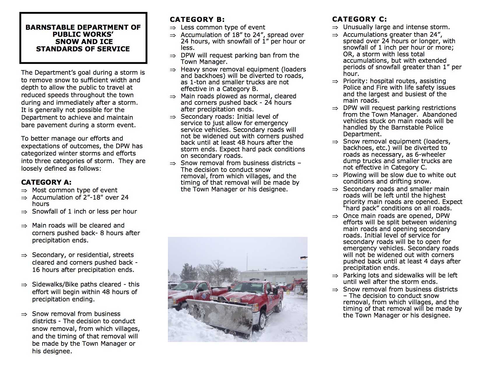
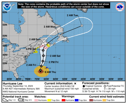
Winter Storm Watch
for Barnstable County
Issued by National Weather Service
Boston, MA
2:54 AM EST Thu, Feb 24, 2022
…WINTER STORM WATCH REMAINS IN EFFECT FROM LATE TONIGHT THROUGH FRIDAY EVENING…
* WHAT…Heavy snow possible. Total snow accumulations of 3 to 6 inches possible. Winds could gust as high as 35 mph.
* WHERE…The south coasts of both Rhode Island and Massachusetts including Cape Cod.
* WHEN…From late tonight through Friday evening.
* IMPACTS…Travel will be be very difficult especially for the Friday morning commute. A flash freeze is possible later Friday afternoon and early evening.
* ADDITIONAL DETAILS…Snow will overspread the region between 1 and 3 am Friday morning. The snow will quickly become heavy, but change to sleet and rain by early to mid morning on Friday. Precipitation may change back to a period of snow later Friday afternoon and early evening along with a potential flash freeze.
PRECAUTIONARY/PREPAREDNESS ACTIONS…
Monitor the latest forecasts for updates on this situation.
VIEW FORECAST HERE
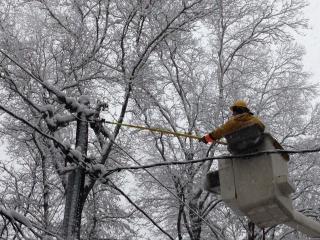
Report a power outage online or call 800-592-2000 Sign-up to receive outage and restoration updates via text, email or phone. By signing up to receive text updates, you’ll also be able to report an outage by text message and receive on-demand updates.
View Eversource Power Outage Map – HERE
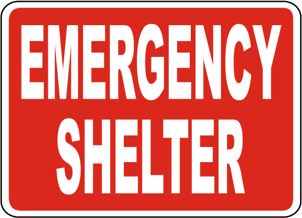
(3) Emergency Shelters are Open
All citizens seeking shelter at one of the open regional shelters, please exercise extreme caution while road conditions remain hazardous. Members of the public are advised to shelter in place, if able, until the wind and snow ease in the late afternoon/evening.
Shelters are staffed by 24 AmeriCorps Cape Cod Members, Members of Regional CERT Teams, and the Cape Cod Medical Reserve Corps. All three locations have emergency food available, provided by the Salvation Army.
The remaining shelters at Dennis-Yarmouth High School, Cape Cod Regional Technical High School, and Nantucket High School are on standby. Check OPEN/CLOSED status of shelters at https://www.bcrepc.org/
The BCREPC wants to emphasize that during shelter operation, COVID-19 remains a significant concern. Residents and visitors should reach out to family and friends first and access shelters only when other options are not available. Likewise, the public is asked to check on neighbors, relatives, and friends who may need assistance.
Masks are required at emergency shelters. People are encouraged to bring their own, but masks will also be available for anyone who needs them.
The Tribal Headquarters in Mashpee will be open for Mashpee Wampanoag Tribe Members to shelter.
Anyone who must utilize a shelter should bring at least three days of essentials, including all medications.
Shelters can accommodate people who use an oxygen breathing apparatus.
Those bringing infants or toddlers to the shelters should also bring formula, food, diapers, wipes, changes of clothing, toys, and a “pack ‘n play” or portable crib and bedding.
Pets are accepted at all regional shelters. Please bring all your pet supplies to the shelter except for crates, which are provided by the shelter. You cannot sleep with your pet(s).
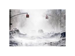
PUBLIC URGED TO STAY INDOORS AND STAY OFF ROADS

Issued by National Weather Service
Boston, MA
3:37 AM EST Sat, Jan 29, 2022
…BLIZZARD WARNING REMAINS IN EFFECT UNTIL 5 AM EST SUNDAY…
* WHAT…Blizzard conditions expected. Total snow accumulations of 18 to 24 inches with localized 30 inches possible. Winds gusting as high as 70 mph.
* WHERE…Portions of eastern, northeastern and southeastern Massachusetts.
* WHEN…From midnight tonight to 5 AM EST Sunday.
* IMPACTS…Travel could be extremely difficult to impossible. Very strong winds could cause extensive tree damage.
* ADDITIONAL DETAILS…Considerable blowing and drifting snow along with near white out conditions at times. Snowfall rates of 2 to 4 inches per hour is possible at times.
PRECAUTIONARY/PREPAREDNESS ACTIONS…
Travel should be restricted to emergencies only. If you must travel, have a winter survival kit with you. If you get stranded, stay with your vehicle.
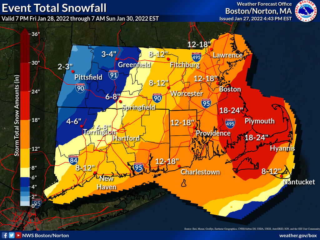
URGENT - WINTER WEATHER MESSAGE
National Weather Service Boston/Norton MA
320 PM EST Thu Jan 27 2022

MAZ017>023-280430-
/O.CON.KBOX.WS.A.0005.220129T0500Z-220130T0500Z/
Northern Bristol MA-Western Plymouth MA-Eastern Plymouth MA-
Southern Bristol MA-Southern Plymouth MA-Barnstable MA-Dukes MA-
Including the cities of Taunton, Brockton, Plymouth, Fall River,
New Bedford, Mattapoisett, Chatham, Falmouth, Provincetown,
and Vineyard Haven
320 PM EST Thu Jan 27 2022

...WINTER STORM WATCH REMAINS IN EFFECT FROM LATE FRIDAY NIGHT
THROUGH SATURDAY EVENING...

* WHAT...Heavy snow possible. Total snow accumulations of 15 to
  22 inches possible. Winds could gust as high as 65 mph.

* WHERE...Portions of southeastern Massachusetts.

* WHEN...From late Friday night through Saturday evening.

* IMPACTS...Travel could be very difficult to impossible. Strong
  winds could cause tree damage.
VIEW FORECAST HERE
Open Burning Season begins January 15 – May 1 between the hours of 10-4. Permits are not required however you must call the Cotuit Fire Department (508)428-2210 after 9:30am on the morning you wish to burn.
MassDEP answers to your burning questions HERE


URGENT - WINTER WEATHER MESSAGE
National Weather Service Boston/Norton MA
1032 PM EST Thu Jan 6 2022

MAZ022-071145-
/O.CON.KBOX.WS.W.0002.220107T0600Z-220107T2100Z/
Barnstable MA-
Including the cities of Chatham, Falmouth, and Provincetown
1032 PM EST Thu Jan 6 2022

...WINTER STORM WARNING REMAINS IN EFFECT UNTIL 4 PM EST FRIDAY...

* WHAT...Heavy snow expected. Total snow accumulations of 1 to 7
  inches. Winds gusting as high as 40 mph.

* WHERE...Barnstable MA County.

* WHEN...Until 4 PM EST Friday.

* IMPACTS...Travel could be very difficult. The hazardous
  conditions could impact the morning commute.

PRECAUTIONARY/PREPAREDNESS ACTIONS...

If you must travel, keep an extra flashlight, food, and water in
your vehicle in case of an emergency.

The latest road conditions for the state you are calling from can
be obtained by calling 5 1 1.
URGENT - WINTER WEATHER MESSAGE
National Weather Service Boston/Norton MA
222 PM EST Thu Jan 6 2022

MAZ022-070900-
/O.UPG.KBOX.WS.A.0003.220107T0600Z-220108T0000Z/
/O.EXB.KBOX.WS.W.0002.220107T0600Z-220107T2100Z/
Barnstable MA-
Including the cities of Chatham, Falmouth, and Provincetown
222 PM EST Thu Jan 6 2022

...WINTER STORM WARNING IN EFFECT FROM 1 AM TO 4 PM EST FRIDAY...

* WHAT...Heavy snow expected. Total snow accumulations of 2 to 7
  inches, heaviest near the Cape Cod Canal.

* WHERE...Barnstable MA County.

* WHEN...From 1 AM to 4 PM EST Friday.

* IMPACTS...Travel could be very difficult. The hazardous
  conditions will impact the morning or evening commute.

* ADDITIONAL DETAILS...Snowfall rates up to 1 inch per hour are
  possible Friday morning. The snow may briefly mix with rain on
  the outer Cape around Chatham to Wellfleet which will result in
  lower accumulations here.

PRECAUTIONARY/PREPAREDNESS ACTIONS...

If you must travel, keep an extra flashlight, food, and water in
your vehicle in case of an emergency.
View Forecast HERE
![]()
![]()
Report a power outage online or call 800-592-2000 Sign-up to receive outage and restoration updates via text, email or phone. By signing up to receive text updates, you’ll also be able to report an outage by text message and receive on-demand updates.
View Eversource Power Outage Map – HERE
Public Health Division offers Influenza Vaccines
DRIVE THRU ONLY
Wednesday Morning September 29, 2021 9:00 am – Noon
Thursday Afternoon October 14, 2021 2- 5 pm
St. George Greek Orthodox Church Route 28, Centerville
These clinics are open to Town of Barnstable Seven Village’s residents only
Please print-out and complete the consent form before arriving to reduce waiting times.
Cost is $3
For More Information contact: Barnstable Health Division or call (508) 862-4644
Attention Swimmers
Cotuit Loop Beach
Effective August 17, 2021 – Lifeguards end duty at Loop Beach
Effective Saturday August 21, 2021 – Staff ends duty, bath house closed for the season.
Portable rest room will remain on site through Labor Day.
Report a power outage online or call 800-592-2000 Sign-up to receive outage and restoration updates via text, email or phone. By signing up to receive text updates, you’ll also be able to report an outage by text message and receive on-demand updates.
View Eversource Power Outage Map – HERE
Report a power outage online or call 800-592-2000 Sign-up to receive outage and restoration updates via text, email or phone. By signing up to receive text updates, you’ll also be able to report an outage by text message and receive on-demand updates.
View Eversource Power Outage Map – HERE
Report a power outage online or call 800-592-2000 Sign-up to receive outage and restoration updates via text, email or phone. By signing up to receive text updates, you’ll also be able to report an outage by text message and receive on-demand updates.
View Eversource Power Outage Map – HERE
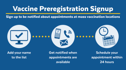 Mass Vaccination Sites
Preregister HERE
COVID-19 Vaccines are FREE
To preregister beginning March 12 and be notified about available vaccine appointments at mass vaccination locations, you will need the following:
To help older people and others who are unable to use the form, family members, caregivers, or other companions can fill out the form on behalf of someone else. People who do not have internet access or someone to fill the form out for them can call 2-1-1 to preregister.
If you are not yet eligible and you sign up, your signup will be valid but you will not be offered appointments until you are eligible. There is no advantage to preregistering before you are eligible.
Massachusetts receives a limited supply of COVID-19 vaccine doses from the federal government each week. Due to high demand and very limited supply, there are a limited number of appointments available for eligible people. Please keep in mind that it could take several weeks or longer to be contacted with an opportunity to schedule your appointment.
After you fill out the preregistration form, your information will be saved and you’ll receive a confirmation through your preferred method of communication (email, text message, or phone call).
Each week, you will receive a weekly status update to:
The opportunity to schedule appointments will be offered to eligible people on a rolling basis. If you are eligible, you will receive appointment notifications based on when you sign up and the availability in your area.
Once notified, you have 24 hours to schedule an appointment.
When an appointment is available for you, you will be contacted through your preferred method of communication.
*****Please note COVID-19 Vaccines are FREE. The Commonwealth of Massachusetts will never ask you for your bank account number, password, or other financial information.
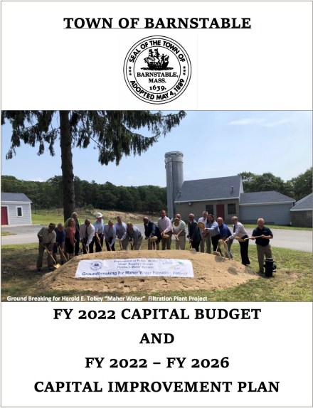
View CIP HERE
2021-108 Ocean View Avenue Resurface
2021-110 No Bottom Pond Storm Water Improvements
2021-111 Santuit River Bridge at School Street Maintenance
Deferred Projects: Cotuit Bay Entrance Dredging, Evaluation of Little River Fish Passage Restoration, Main & School Streets Raised Crosswalks (3), Cotuit Memorial Park Restoration, Private Road Repair (Banfield Road), Mosswood Cemetery Building Improvements, Cotuit Elementary School Demolition.
Report a power outage online or call 800-592-2000 Sign-up to receive outage and restoration updates via text, email or phone. By signing up to receive text updates, you’ll also be able to report an outage by text message and receive on-demand updates.
View Eversource Power Outage Map – HERE

URGENT - WINTER WEATHER MESSAGE
National Weather Service Boston/Norton MA
316 AM EST Sun Feb 7 2021

MAZ017>022-RIZ002>007-071630-
/O.CON.KBOX.WS.W.0003.210207T1200Z-210208T0600Z/
Northern Bristol MA-Western Plymouth MA-Eastern Plymouth MA-
Southern Bristol MA-Southern Plymouth MA-Barnstable MA-
Southeast Providence RI-Western Kent RI-Eastern Kent RI-
Bristol RI-Washington RI-Newport RI-
Including the cities of Taunton, Brockton, Plymouth, Fall River,
New Bedford, Mattapoisett, Chatham, Falmouth, Provincetown,
Providence, Coventry, West Greenwich, East Greenwich, Warwick,
West Warwick, Bristol, Narragansett, Westerly, and Newport
316 AM EST Sun Feb 7 2021
..WINTER STORM WARNING REMAINS IN EFFECT FROM 7 AM THIS MORNING TO 1 AM EST MONDAY…
* WHAT…Heavy snow expected. Total snow accumulations of 4 to 8 inches. Winds gusting as high as 40 mph.
* WHERE…Portions of southeastern Massachusetts and northern and southern Rhode Island.
* WHEN…From 7 AM this morning to 1 AM EST Monday.
* IMPACTS…Travel could be very difficult. Wet snow may result in isolated power outages if the higher amounts are realized.
* ADDITIONAL DETAILS…Snow overspreads the region this morning and continues through the afternoon. The snow may begin as a brief period of rain before changing to snow.
PRECAUTIONARY/PREPAREDNESS ACTIONS…
If you must travel, keep an extra flashlight, food, and water in your vehicle in case of an emergency.
VIEW FORECAST HERE
View Legally Posted Agendas HERE
Cotuit Fire District Cotuit School Committee – Thursday February 4, 6pm
Town Council Meeting – Thursday February 4, 7pm, REMOTE
Town Council Zoning & Regulatory Review Committee – Tuesday February 9, 5:30pm, Remote
Cotuit Fire Commission – Tuesday February 9, 5:30pm, Remote
Precinct 7 Monthly Open Meeting at Library– Cancelled until Further Notice (email or call Jessica w/ concerns)
Town Council Appointments Committee – Tuesday February 16, 5:30pm, REMOTE
Town Council Asset Management Advisory Committee – Wednesday February 17, 5:30pm, Remote
Town Council Meeting – Thursday February 18, 7pm, REMOTE
Cotuit Prudential Committee – Monday February 22, 5:30pm, Remote
Cotuit Water Commission – Wednesday February 24, 5:45pm, REMOTE
Cotuit Fire District Cotuit School Committee – Thursday February 25, 3pm
Cotuit Fire District By-Laws Committee TBD
Cotuit Fire District Policy Advisory Committee-Next Month
Town Council Homelessness Committee – TBD
Town Council Roads Committee – Inactive
Open Burning Season begins January 15 – May 1 between the hours of 10-4. Permits are not required however you must call the Cotuit Fire Department (508)428-2210 after 9:30am on the morning you wish to burn.

MassDEP answers to your burning questions HERE
Reminder To avoid a Late Fee, Renew your Burglar Alarm Registration with the Barnstable Police Department prior to January 31, 2021
View Legally Posted Agendas HERE
Cotuit Fire District Cotuit School Committee – Wednesday January 6, 6pm, Remote
Town Council Meeting – Thursday January 7, 7pm, REMOTE
Precinct 7 Monthly Open Meeting – Wednesday January 13, Cancelled (For assistance contact Jessica, Precinct7@comcast.net)
Cotuit Fire District Cotuit School Committee – Wednesday January 13, 4pm, Remote (Executive Session, No Public Comment)
Town Council Appointments Committee – Tuesday January 19, 5:30pm, REMOTE
Cotuit Fire Commission – Tuesday January 19, 6pm, Remote
Cotuit Water Commission – Wednesday January 20, 5:45pm, REMOTE
Cotuit Fire District Cotuit School Committee – Thursday January 21, 6pm, Remote (No Public Comment on Agenda)
Town Council Meeting – Thursday January 21, 7pm, REMOTE
Cotuit Fire District By-Laws Committee- Monday January 25, 5pm, Remote
Cotuit Prudential Committee – Monday January 25, 6pm, REMOTE
Cotuit Fire District Policy Advisory Committee- Monday January 25, 7pm, Remote
————————————————————————————————
Town Council Asset Management Advisory Committee – TBD
Town Council Homelessness Committee – TBD
Town Council Roads Committee – Inactive
Town Council Zoning & Regulatory Review Committee – TBD

Dear BPS Community, Thursday, December 17, will be a snow day for Barnstable students and staff. The district will be closed for in-person and virtual learning. We wish all of our students and staff a wonderful day with their favorite … Continue reading
Updates on Wastewater Efforts in the Town of Barnstable
Update: 12/17/20: View DRAFT Sewer Assessment Ordinance HERE
View Financing the CWMP & Fiscal Policy Decisions HERE
Presented By Mark Milne, Director of Finance at the
Special Town Council Meeting December 10, 2020
View Special Meeting Video HERE
FISCAL POLICY RE: CWMP
View Director Of Finance, Mark Milne’s October 29, 2020 Presentation to Town Council HERE
UPDATE: October 15, 2020
View Update HERE
UPDATE: September 17, 2020
View Update HERE
UPDATE: September 11, 2020
FOR IMMEDIATE RELEASE
CONTACT: Nate Collins, P.E. Telephone: 774-487-8390
ROUTE 28 SEWER EXPANSION PROJECT GEOTECHNICAL BORINGS
The Town of Barnstable’s design consultant (Weston & Sampson) will be completing geotechnical borings for the proposed Rte. 28 East Sewer Expansion Project starting on September 14th. Work will include approximately thirty-one (31) soil borings within the State Highway Layout of Route 28 (Falmouth Road) in Barnstable, MA, between the intersection with Phinneys Lane and just east of the intersection with Pitchers Way. The traffic flow will be maintained throughout the drilling, including proper signage. It is envisioned that the soil boring work within Route 28 will take up to two (2) weeks.
UPDATE: August 20, 2020
View CWMP Update HERE
UPDATE: July 16, 2020
OTHER WASTEWATER PROJECTS OF NOTE (NON-SEWER EXPANSION)
UPDATE: April 16, 2020
o Received ENF decision on April 3, 2020.
o Next Step – Prepare and submit Single EIR, anticipated this summer
o Project includes Phinney’s Lane pump station, force main to back to WPCF and gravity sewer on Route 28 from Strawberry Hill Road to Phinneys Lane and on Phinneys Lane from Wequaquet Lane to Route 28.
o Targeting Fall, 2021 construction.
o Phinney’s Lane Sewer Expansion (neighborhoods to west and east side of Phinney’s Lane)
o Long Pond Sewer Expansion
o Route 28 Centerville and Marstons Mills (from Phinneys Lane to Route 149, including MMWWTP conversion).
UPDATE: February 27, 2020 View DPW Presentation to Town Council HERE
UPDATE: January 24, 2020 View DPW Presentation to Town Council HERE
UPDATE: January 14, 2020 View Expanded Environmental Notification Form HERE
UPDATE: January 2020 View Final Comprehensive Wastewater Management Plan HERE
UPDATE: January 2020 View CWMP Appendices HERE
UPDATE: December 19, 2019 View DPW Presentation to Town Council HERE
UPDATE: November 21, 2019 View DPW Presentation to Town Council HERE
UPDATE: October 3, 2019 View Final Draft of the Comprehensive Wastewater Management Plan HERE View Financing Plan for the Comprehensive Wastewater Management Plan HERE
UPDATE: October 3, 2019 The Town will host a series of four public information sessions over the next 30 days that will allow the public to hear about the plan, ask questions, and offer comments. Information sessions will be held at 6:30 pm in Barnstable County Complex Conference Room 10/15, Hyannis Town Hall 10/22, Marstons Mills Liberty Hall 10/28 & Osterville Library 10/21.
For More Information Contact: Daniel W. Santos, P.E. Director of Public Works Daniel.Santos@town.barnstable.ma.us
The Town of Barnstable Department of Public Works released the Draft Comprehensive Wastewater Management Plan (CWMP). The Draft CWMP will guide wastewater collection, treatment, and disposal efforts in Barnstable for the next 30 years, with the primary goals of reducing nutrient enrichment of coastal estuaries and fresh water ponds as well as the protection of public water supplies. Secondary goals include supporting economic growth and providing solutions in areas where it has traditionally been difficult to site on-site systems such as areas with high groundwater and poor soils. The Draft CWMP relies on both traditional methods of addressing wastewater, in the form of centralized collection and treatment, but also invests heavily in alternative technologies in the short term to potentially minimize the need for centralized sewering in later phases of the plan.
The Town has been working since 2015 to develop a plan that meets the needs of the community as well as the requirements of the Cape Commission’s “208 Plan” that was released in 2017. The “208 Plan” outlines the region’s plan to meet the requirements of the Federal Clean Water Act.
UPDATE: June 20, 2019 View recent Comprehensive Wastewater Management Plan (CWMP) Power Point Presentation HERE
UPDATE: January 3, 2019 View Power Point Presentation on Wastewater Efforts in Barnstable HERE
UPDATE: November 17, 2017 View details HERE outlining Intermunicipal Agreement between Barnstable, Mashpee and Sandwich to Clean Up Popponesset Bay.
UPDATE: August 17, 2017 View Final Wastewater Planning Presentation to Town Council HERE
 UPDATE: June 17, 2017 The Town of Barnstable’s Water Resources Advisory Committee held a workshop on Saturday June 17, 2017 to discuss the timeline, process and preliminary costs associated with cleaning up Barnstable’s ponds, rivers, shorelines and embayments. View meeting HERE
UPDATE: May 17, 2017 View Barnstable’s Draft Wastewater Plan HERE presented by DPW to the Water Resources Advisory Committee (WRAC) and Town Council Barnstable Walling Map – 1856


You must be logged in to post a comment.