
View Barnstable eNews HERE
View the new Barnstable eNews Website HERE


Issued by National Weather Service
Boston, MA
3:37 AM EST Sat, Jan 29, 2022
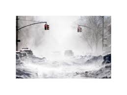
…BLIZZARD WARNING REMAINS IN EFFECT UNTIL 5 AM EST SUNDAY…
* WHAT…Blizzard conditions expected. Total snow accumulations of 18 to 24 inches with localized 30 inches possible. Winds gusting as high as 70 mph.
* WHERE…Portions of eastern, northeastern and southeastern Massachusetts.
* WHEN…From midnight tonight to 5 AM EST Sunday.
* IMPACTS…Travel could be extremely difficult to impossible. Very strong winds could cause extensive tree damage.
* ADDITIONAL DETAILS…Considerable blowing and drifting snow along with near white out conditions at times. Snowfall rates of 2 to 4 inches per hour is possible at times.
PRECAUTIONARY/PREPAREDNESS ACTIONS…
Travel should be restricted to emergencies only. If you must travel, have a winter survival kit with you. If you get stranded, stay with your vehicle.
URGENT - WINTER WEATHER MESSAGE
National Weather Service Boston/Norton MA
320 PM EST Thu Jan 27 2022

MAZ017>023-280430-
/O.CON.KBOX.WS.A.0005.220129T0500Z-220130T0500Z/
Northern Bristol MA-Western Plymouth MA-Eastern Plymouth MA-
Southern Bristol MA-Southern Plymouth MA-Barnstable MA-Dukes MA-
Including the cities of Taunton, Brockton, Plymouth, Fall River,
New Bedford, Mattapoisett, Chatham, Falmouth, Provincetown,
and Vineyard Haven
320 PM EST Thu Jan 27 2022

...WINTER STORM WATCH REMAINS IN EFFECT FROM LATE FRIDAY NIGHT
THROUGH SATURDAY EVENING...

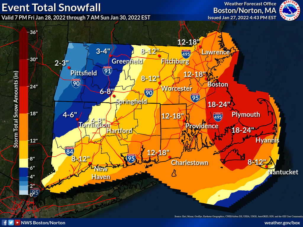
* WHAT...Heavy snow possible. Total snow accumulations of 15 to
  22 inches possible. Winds could gust as high as 65 mph.

* WHERE...Portions of southeastern Massachusetts.

* WHEN...From late Friday night through Saturday evening.

* IMPACTS...Travel could be very difficult to impossible. Strong
  winds could cause tree damage.
VIEW FORECAST HERE
URGENT - WINTER WEATHER MESSAGE
National Weather Service Boston/Norton MA
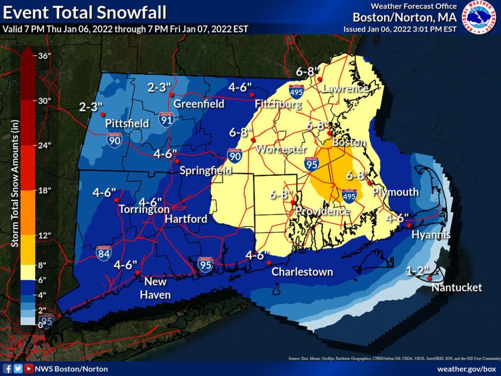
1032 PM EST Thu Jan 6 2022

MAZ022-071145-
/O.CON.KBOX.WS.W.0002.220107T0600Z-220107T2100Z/
Barnstable MA-
Including the cities of Chatham, Falmouth, and Provincetown
1032 PM EST Thu Jan 6 2022

...WINTER STORM WARNING REMAINS IN EFFECT UNTIL 4 PM EST FRIDAY...

* WHAT...Heavy snow expected. Total snow accumulations of 1 to 7
  inches. Winds gusting as high as 40 mph.

* WHERE...Barnstable MA County.

* WHEN...Until 4 PM EST Friday.

* IMPACTS...Travel could be very difficult. The hazardous
  conditions could impact the morning commute.

PRECAUTIONARY/PREPAREDNESS ACTIONS...

If you must travel, keep an extra flashlight, food, and water in
your vehicle in case of an emergency.

The latest road conditions for the state you are calling from can
be obtained by calling 5 1 1.
URGENT - WINTER WEATHER MESSAGE
National Weather Service Boston/Norton MA
222 PM EST Thu Jan 6 2022

MAZ022-070900-
/O.UPG.KBOX.WS.A.0003.220107T0600Z-220108T0000Z/
/O.EXB.KBOX.WS.W.0002.220107T0600Z-220107T2100Z/
Barnstable MA-
Including the cities of Chatham, Falmouth, and Provincetown
222 PM EST Thu Jan 6 2022

...WINTER STORM WARNING IN EFFECT FROM 1 AM TO 4 PM EST FRIDAY...

* WHAT...Heavy snow expected. Total snow accumulations of 2 to 7
  inches, heaviest near the Cape Cod Canal.

* WHERE...Barnstable MA County.

* WHEN...From 1 AM to 4 PM EST Friday.

* IMPACTS...Travel could be very difficult. The hazardous
  conditions will impact the morning or evening commute.

* ADDITIONAL DETAILS...Snowfall rates up to 1 inch per hour are
  possible Friday morning. The snow may briefly mix with rain on
  the outer Cape around Chatham to Wellfleet which will result in
  lower accumulations here.

PRECAUTIONARY/PREPAREDNESS ACTIONS...

If you must travel, keep an extra flashlight, food, and water in
your vehicle in case of an emergency.
View Forecast HERE


You must be logged in to post a comment.