
View Barnstable eNews HERE
View the new Barnstable eNews Website HERE

Winter Storm Watch
for Barnstable County
Issued by National Weather Service
Boston, MA
2:54 AM EST Thu, Feb 24, 2022
…WINTER STORM WATCH REMAINS IN EFFECT FROM LATE TONIGHT THROUGH FRIDAY EVENING…
* WHAT…Heavy snow possible. Total snow accumulations of 3 to 6 inches possible. Winds could gust as high as 35 mph.
* WHERE…The south coasts of both Rhode Island and Massachusetts including Cape Cod.
* WHEN…From late tonight through Friday evening.
* IMPACTS…Travel will be be very difficult especially for the Friday morning commute. A flash freeze is possible later Friday afternoon and early evening.
* ADDITIONAL DETAILS…Snow will overspread the region between 1 and 3 am Friday morning. The snow will quickly become heavy, but change to sleet and rain by early to mid morning on Friday. Precipitation may change back to a period of snow later Friday afternoon and early evening along with a potential flash freeze.
PRECAUTIONARY/PREPAREDNESS ACTIONS…
Monitor the latest forecasts for updates on this situation.
VIEW FORECAST HERE
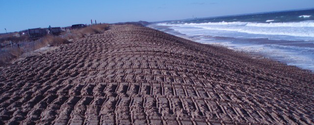
The Town of Barnstable is currently updating the Barnstable Hazard Mitigation Plan (HMP) and is seeking public comment at this time.
Draft plan for public comment can be found here:
DRAFT HAZARD MITIGATION PLAN UPDATE
Please provide all comments to james.kupfer@town.barnstable.ma.us by March 18, 2022.
The Town of Barnstable is currently updating the Barnstable Hazard Mitigation Plan (HMP). The HMP is a planning document that is required by both FEMA and MEMA to be updated every 5 years in order to remain eligible for certain funding opportunities. The Planning and Development department is the lead coordinator in an interdepartmental effort to update the plan.
The purpose of the plan is to identify and profile the town’s risk and vulnerability to potential natural hazards. Specifically, this plan assesses the potential impacts of hurricanes, winter storms, shoreline change/coastal erosion, earthquakes, drought/wildfire, and dam failure and identifies properties, resources, and critical facilities which may be impacted by these hazard events. The plan identifies mitigation strategies and actions aimed at reducing the loss of or damage to life, property, infrastructure and natural, cultural, and economic resources. A corresponding implementation plan will then be prepared to address the prioritization and administration of the identified strategies and actions.

Cotuit Fire District Prudential Committee

Cotuit School Sub Committee Meets
Thursday February 24, 2022 7pm, Remote
View Agenda HERE
Nomination papers for the following offices are available at
Cotuit Fire Station, 64 High Street, Cotuit MA, 02635
Prudential Committee – 3 Year Term
Board of Water Commissioners – 3 Year Term
Board of Fire Commissioners – 3 Year Term
Moderator – 3 Year Term

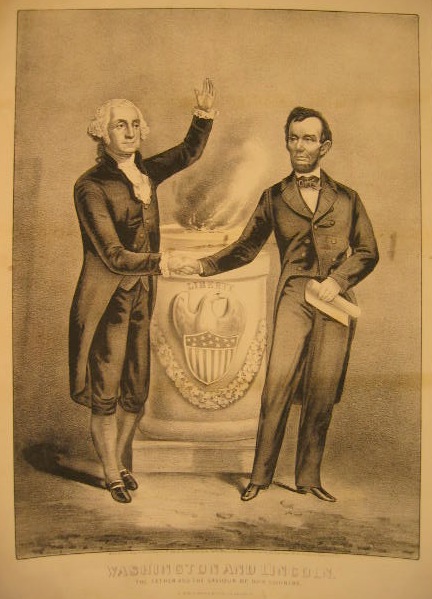
Today is President’s Day!
The 12th marks the birth of Abraham Lincoln (1809-1865)
The 22nd marks the birth of George Washington (1732-1799)
Barnstable Transfer Station Hours of Operation
Monday, February 21, 2022
The Town of Barnstable Department of Public Works Solid Waste Division will be closed Monday, February 21, 2022 in observance of President’s Day. Trash and recycling services will resume on a normal schedule Tuesday, February 22, 2022.

URGENT - WEATHER MESSAGE
National Weather Service Boston/Norton MA
307 AM EST Thu Feb 17 2022

MAZ020>024-RIZ004>008-172115-
/O.CON.KBOX.HW.W.0003.220218T0400Z-220218T1400Z/
Southern Bristol MA-Southern Plymouth MA-Barnstable MA-Dukes MA-
Nantucket MA-Eastern Kent RI-Bristol RI-Washington RI-Newport RI-
Block Island RI-
Including the cities of Fall River, New Bedford, Mattapoisett,
Chatham, Falmouth, Provincetown, Vineyard Haven, Nantucket,
East Greenwich, Warwick, West Warwick, Bristol, Narragansett,
Westerly, Newport, and New Shoreham
307 AM EST Thu Feb 17 2022
...HIGH WIND WARNING REMAINS IN EFFECT FROM 11 PM THIS EVENING TO
9 AM EST FRIDAY...

* WHAT...Southwest winds 30 to 40 mph with gusts up to 65 mph
expected.

* WHERE...In Massachusetts, Southern Bristol MA, Southern
Plymouth MA, Barnstable MA, Dukes MA and Nantucket MA
Counties. In Rhode Island, Block Island RI, Newport RI,
Washington RI, Eastern Kent RI and Bristol RI Counties.

* WHEN...From 11 PM this evening to 9 AM EST Friday.

* IMPACTS...Damaging winds will blow down trees and power lines.
Widespread power outages are expected. Travel will be
difficult, especially for high profile vehicles.


You must be logged in to post a comment.