
To celebrate Independence Day, the Oyster Harbors Club hosts Fireworks July 1st, 2018, 9pm Cotuit Inner Harbor

To celebrate Independence Day, the Oyster Harbors Club hosts Fireworks July 1st, 2018, 9pm Cotuit Inner Harbor
View HERE
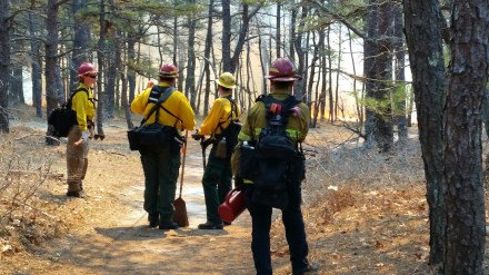
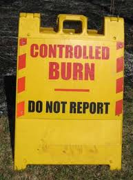
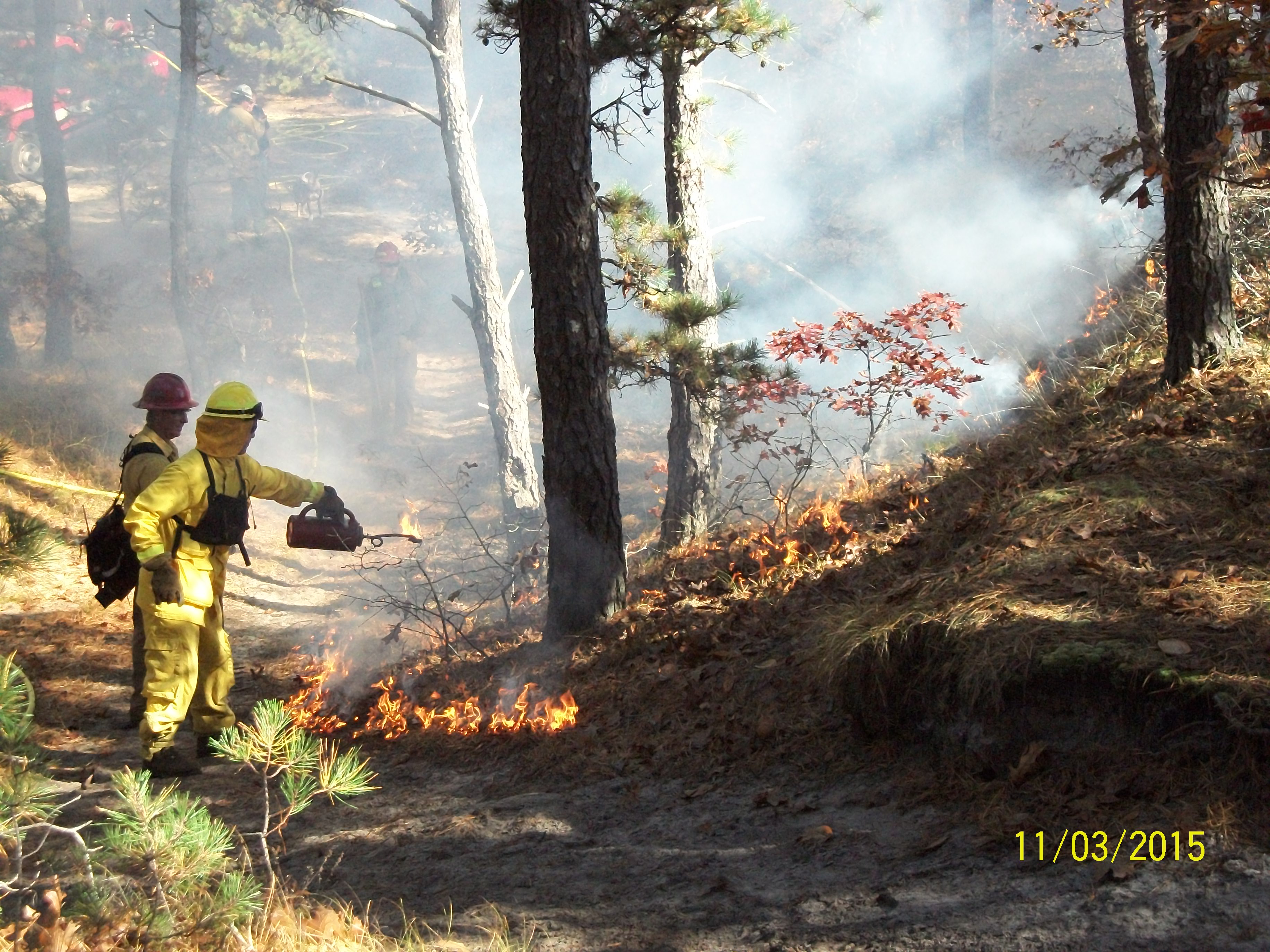
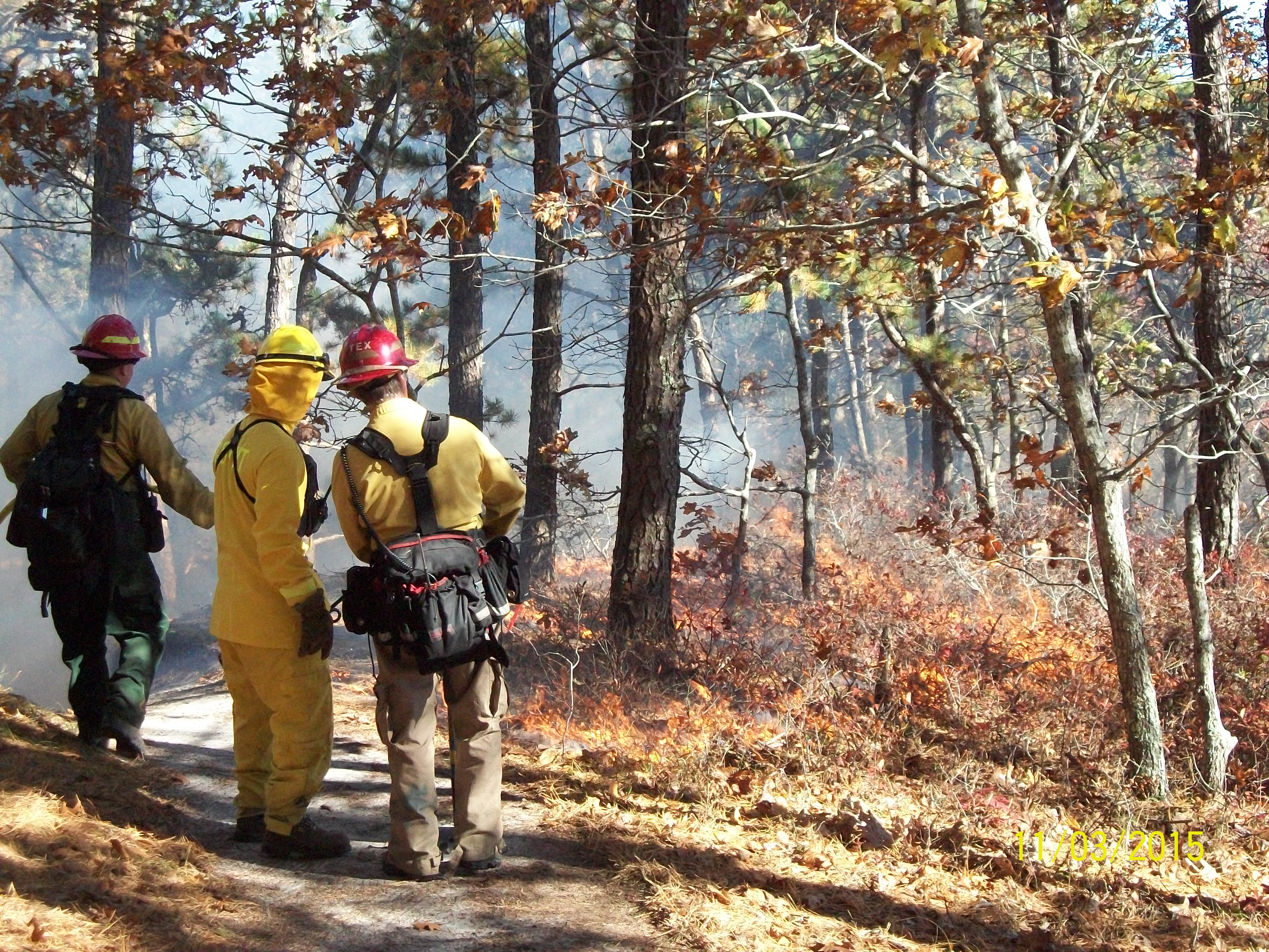
CROCKER NECK CONSERVATION AREA
PRESCRIBED BURN SCHEDULED
* WEATHER PERMITTING*
Wednesday June 27, 2018
When: Scheduled from 9:00AM to 5:00PM
PLEASE KEEP YOUR DISTANCE FROM BURN AREA
WHERE CONTRACTORS ARE WORKING
Why: This type of controlled prescribed fire management promotes fresh growth of new plants, provides habitat and foraging opportunities for local wildlife, and also serves as wildfire prevention and refuge for people caught in between a wildfire event. Surrounding neighborhoods are protected by reducing the chance of wildfire in Crocker Neck by conducting these low burning controlled fires on a regular basis.
See Map of Area HERE
Darcy Karle, Conservation Administrator
darcy.karle@town.barnstable.ma.us P 508-862-4093
Cotuit Fire Department will be issuing a reverse 911 notice!
UPDATE: June 28,2018
The prescribed burn at Crocker Neck yesterday was successful. Twenty-two acres were treated by reducing forest floor fuels for potential wildfire risk!
There were 5 staff from NE-FFM, 5 crew members from the Mass DCR fire district (free service), and 2 from Cotuit fire conducting the burn.
The costs will be reimbursed through the Mass Wildlife 2018 Habitat Management grant award to Barnstable Conservation.

The Cotuit & COMM Fire Departments are hosting a free car seat check and installation event.
Saturday, June 23, 2018
9-10 am Cotuit Fire Station, 64 High Street, Cotuit
11am-12pm COMM Fire Station, 1875 Rt. 28, Centerville
·Free car/booster seat inspection
·Free car/booster seat installation assistance
·Free check for recalls
UPDATE: 6/14/18 Due to weather conditions the burn has been cancelled.
UPDATE: 6/12/18 The prescribed burn at Crocker Neck is now scheduled for Thursday or Friday June 14 or 15, weather dependent. The Fire Department will issue a phone notification if given the green light.
UPDATE: 4/27/18 The prescribed burn at Crocker Neck is on hold until late May, to prevent unnecessary damage to oak trees. Once the leaves are out, they will be less susceptible to damage from a low slow burn. This cold spring and wet year have played havoc on burn schedules.
Check back for Updates!
The Barnstable Conservation Division has contracted with Northeast Forest and Fire Management LLC to conduct another prescribed burn in the Crocker Neck Conservation Area of Cotuit. They will be focusing on Subunits B & D. See map of Subunits Here. Depending on weather conditions, it is scheduled for Monday April 23, 2018. If it is a go a phone notification will be issued by the Cotuit Fire Department to nearby residents.
More Information HERE

Cotuit Fire District Fire Commissioner’s Meeting
Tuesday June 12, 5:30pm, Freedom Hall
View Agenda HERE
View listing HERE
…WINTER WEATHER ADVISORY WEDNESDAY 3/21/18 5pm THROUGH THURSDAY 3/22/18 MORNING…
* WHAT… Wet snow. Total snow accumulations will range from 3 to 5 inches on the upper Cape, Martha`s Vineyard, and Block Island, to as little as 1 to 2 inches on the outer Cape.
* WINDS…Northeast 20 to 30 mph with gusts up to 60 mph with the strongest winds Wednesday night into Thursday morning.
* WHERE…Cape Cod and the Islands.
* WHEN…From Wednesday morning through Thursday morning.
* ADDITIONAL DETAILS…Plan on difficult travel conditions. Tree branches could fall. Significant reductions in visibility are possible.
VIEW FORECAST HERE
March 15, 2018 UPDATE: All Shelters Now Closed
EMERGENCY SHELTERS OPEN!
* Barnstable Intermediate School, 895 Falmouth Road, Hyannis will remain open until 10 AM Thursday March 15. This is a pet -friendly shelter.
* Sandwich High School, 365 Quaker Meetinghouse Road, Sandwich
* Cape Cod Regional Technical School, 351 Pleasant Lake Avenue, Harwich
View listing HERE
For downed trees, please call the Highway Department 508-790-6330
March 14, 2018 08:00 AM Town of Barnstable Employees: Town offices are open today subject to power outages. At this time Town Hall, Police Station, DPW Facilities, 200 Main Street, MEA Building, and Senior Center have power. Please check with your manager as to the status of the facility at which you work. For the Public: Please check with the department you wish to conduct business with as to its status of operation before visiting the facility.
March 13, 2018 9:30 PM We apologize for the break in coverage on the Storm Alerts. Power outages prevented us from regularly updating the website. Crews have been out all day plowing and removing trees and we expect to be at it into the early morning hours tomorrow. There are still a large number of trees that are down and blocking roads (we have had over 200 trees reported down today), many of which are tangled in wires. Please use extreme caution when moving around the Town.
March 13, 2018 3:00 PM Though the snow accumulations have not been as dire as expected, the winds and weight of the snow is taking its toll. To date we have over 185 trees down across Town, many with wires associated with them. We also have a large number of utility poles that have been broken. As a result, the Town is experiencing extensive power losses. Street lights and traffic lights are not working in many locations. In addition to the plow crews, we have four tree crews working to make roads passable. However, please do not leave where you are unless you absolutely need to do so.As always, please follow the advice of public safety officials. Be safe!
March 13, 2018 09:30 AM – We are experiencing heavy snows and high winds. All crews are out plowing. Additionally, we have had over 30 tree calls already this morning, with more coming all the time, so have three tree crews deployed to address them. Driving conditions are treacherous, and many roads have impediments to travel due to the downed trees or downed wires. Please remain where you are if at all possible.
March 13, 2018 05:30 AM – Good morning, winter storm Skylar has begun. Roads are already coated with snow, and forecasts are for significant snowfall (multiple inches per hour) throughout the morning and early afternoon. Winds are also going to be gusting making drifting an issue. DPW is already out salting main roads, and will soon be plowing main and secondary roads. If the predicted rate of snow materialize, it is very likely we will be struggling to keep up until the storm moderates, and drifting will exasperate that situation. As a result, it is likely roads will become snow filled between plow passes, and driving will be difficult. Please stay off the roads if at all possible. It would also be very helpful if you do go out if you could refrain from parking on the main streets of Hyannis, Barnstable and Osterville villages. Please also be aware that secondary roads will only initially be plowed to allow access, and will be “cleaned up” toward the end of the storm when snowfall rates decline.
March 13, 2018 05:00 AM – Due to the impending storm, Town Manager Mark Ells has said that Town of Barnstable municipal buildings will be closed today, Tuesday, March 13th. All non-essential personnel will be off today. If you have any questions as to whether you are considered essential or non-essential for this particular type of storm, please contact your direct supervisor.
March 13, 2018 05:00 AM – Due to the storm, the Transfer Station at 45 Flint Street, Marstons Mills, will be closed on Tuesday, March 13, 2018
EVERSOURCE – Click Here for Map

March 13 and 14, 2018

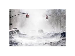 …BLIZZARD WARNING IN EFFECT FROM 11 PM THIS EVENING TO 8 PM EDT TUESDAY…
* WHAT…Blizzard conditions expected. Winds gusting as high as 65
mph will cause whiteout conditions in blowing snow. Significant
drifting of the snow is likely. Total snow accumulations of 10
to 18 inches with localized 20 inch amounts possible.
* WHERE…Coastal Essex County, Plymouth County, Cape Cod and
Marthas Vineyard.
* WHEN…From 11 PM this evening to 8 PM EDT Tuesday.
* ADDITIONAL DETAILS…Travel will be very dangerous with 1 to 3
inch per hour snowfall rates at times and significantly impact
the morning commute. The Tuesday afternoon commute is also
expected to be impacted. Wet snow and strong winds will result
in some power outages and tree damage.


…HIGH WIND WARNING IN EFFECT FROM 1 PM WEDNESDAY TO 1 AM THURSDAY…
The National Weather Service in Taunton has issued a High Wind
Warning, which is in effect from 1 PM Wednesday, March 7 to 1 AM Thursday, March 8.
* Location…Eastern Massachusetts from Plymouth County to Cape
Cod and the Islands.
* Winds…East 20 to 30 mph with gusts up to 60 mph.
* Timing…Strongest winds Wednesday afternoon and evening.
* Impacts…Damage to trees, power lines, and property are
possible with winds of this magnitude. Power outages are likely.
PRECAUTIONARY/PREPAREDNESS ACTIONS…
A High Wind Warning is issued when sustained winds of 40 mph are
expected for at least one hour, with gusts of 58 mph or greater
at any time. Take action to secure loose outdoor objects.

CLOSED at 4pm Sunday.
The Town of Barsnatble’s Emergency Shelter will be opening at 5pm today Saturday March 3, 2018. The Shelter is located at the Barnstable Intermediate School, 895 Falmouth Road (Route 28), Hyannis. It is a pet friendly shelter.
As the storm continues to pull away from the region, the Barnstable Police have dedicated all resources to addressing the needs of the community. Several roadways have been affected by flooding, tree and limb debris, and severed or low hanging utility wires. The following road closures are in effect during clean-up efforts, and as flood waters subside.
· Rte 6A at the Sandwich Town Line
· Rte. 6A at High St.
· Rte 6A at Millway
· Millway and Commerce Rd.
· Freezer Rd.
· Rte. 6A at Keveney
· Bragg’s Lane
· Main St. Cotuit at Screecham Rd.
· 1029 Ostervile West Barnstable Rd.
· Osterville West Barnstable Rd. from Race Ln. to Rte. 149
· Old Shore Rd. Cotuit
· Flint St. between Rte. 149 and Calvin Hamblin Way
As reported by Eversource earlier today, extra tree and line crews have been dispatched to the most needed areas, and a significant impact on power restoration efforts is anticipated throughout the day.
The Barnstable Police urge all citizens to use caution when utilizing public ways, and to remain a safe distance from flooded areas and downed utility wires.

…WINTER WEATHER ADVISORY IN EFFECT FROM 7 PM THIS EVENING TO 7 AM EST SUNDAY…
* WHAT…Snow expected. Plan on difficult travel conditions. Total
average snow accumulations of 2 to 4 inches are expected.
Locally higher amounts up to 7 inches possible across the upper
Cape.
* WHERE…Barnstable County.
* WHEN…From 7 PM this evening to 7 AM EST Sunday.
* ADDITIONAL DETAILS…Be prepared for reduced visibilities at
times. Untreated surfaces will be slippery.
PRECAUTIONARY/PREPAREDNESS ACTIONS…
A Winter Weather Advisory for snow means periods of snow will
cause primarily travel difficulties. Be prepared for snow covered
roads and limited visibilities, and use caution while driving.
Weather Forecast Here
View listing HERE
Remains in Effect until January 30, 1 pm
View Weather Forecast Here

The Town of Barnstable Public Health Division will hold a flu clinic at the Hyannis Youth and Community Center Today January 18, 2018. This clinic is open to all Town residents.
Thursday January 18, 2018, 9:30 a.m. – 11:30 a.m.
Hyannis Youth & Community Center 141 Bassett Lane, Hyannis
For More Information
Call (508) 862-4644
The Town of Barnstable Public Health Division will hold a flu clinic at the Hyannis Youth and Community Center on Thursday January 18, 2018. This clinic is open to all Town residents.
Thursday January 18, 2018, 9:30 a.m. – 11:30 a.m.
Hyannis Youth & Community Center 141 Bassett Lane, Hyannis
For More Information
Call (508) 862-4644
Weather Forecast Here

Permits are not required however you must call the fire department on the morning you wish to burn: Cotuit Fire Department (508)428-2210 will give you the ok to proceed, weather dependent. View Safety Tips HERE

Starting Tomorrow, Open Burning Season January 15 – May 1 between the hours of 10-4.
Permits are not required however you must call the fire department on the morning you wish to burn: Cotuit Fire Department (508)428-2210 will give you the ok to proceed, weather dependent.
MassDEP answers to your burning questions HERE
|
The Town of Barnstable Public Health Division will hold a flu clinic at the Hyannis Youth and Community Center on January 18th. This clinic is open to all Town residents. The fee is $3.00 Thursday January 18th 9:30 a.m. – 11:30 a.m. Hyannis Youth & Community Center For More Information: Call the Town of Barnstable Public Health Division at (508) 862-4644 |
DPW STORM UPDATE!
January 4, 2018 10:30 PM – The bulk of the snow has ended. We have begun final salting of the main roads. Once that has been completed we will begin salting secondary roads. We expect that to be completed at approximately 4:00 AM. Temperatures are dropping, so walks and areas that do not have salt on them will be slick. If you go out, please be cautious.
January 4, 2018 7:30 PM – We still are experiencing bands of snow coming through, and as a result are continuing to scrape and salt the main roads. Secondary road plow drivers are on their routes as well. Once the snow stops falling, crews will finish scraping and apply an application of salt on all roads (mains and secondary roads), and parking lots. Please be aware, temperatures have dropped below freezing and with all of the moisture we received there is a lot of ice on walks and roads. If you must go out, please proceed with caution.
January 4, 2018 2:00 PM – The rain has started to turn to snow. Western portions of the Town are reporting heavy slush on the roads, and the eastern portions are starting to shush up as well. We are dispatching the main road plows and spreaders to start to scrape off the slush and get a layer of salt down. Secondary road contractors have been called in, and should be on their routes in an hour or so. We have also experienced flooding in coastal areas on the north side of town due to the high tides and wind pushing water on shore. If you must travel, please be aware that as temperatures continue to drop all of the moisture on the roads will freeze and driving will become hazardous.
January 4, 2018 08:15 AM – Good morning, our first large storm of the season is at our doorstep. “Grayson”, as named, is predicted to bring us rain through mid-day, then transition to a mix, and finally become just snow. Depending on the forecast you listen to, snow totals are predicted from less than an inch to up to 4-8 inches. As a result, the DPW is preparing for the higher amounts, and will adjust if get the lesser totals. Spreaders are on site standing by to address icing, and main road plows will be on station starting at 10AM in the event of an early turn-over. Tree crews are also ready in the event that the predicted winds cause tree damage. Finally we are monitoring for possible flooding due to rain falling on frozen ground, and the timing of high tides. At this point we just need to wait to see what Mother Nature send us. All forecasts are predicting that driving conditions this afternoon will be poor, so please stay in if possible.
As a reminder, the Transfer Station will be closing at noon, or sooner if the winds intensify faster than predicted.
Track Snow Fleet HERE
View listing HERE
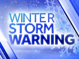
URGENT - WINTER WEATHER MESSAGE
National Weather Service Taunton MA
1022 PM EST Wed Jan 3 2018

MAZ022-023-041130-
/O.CON.KBOX.WS.W.0001.180104T1500Z-180105T0600Z/
Barnstable MA-Dukes MA-
Including the cities of Chatham, Falmouth, Provincetown,
and Vineyard Haven
1022 PM EST Wed Jan 3 2018

...WINTER STORM WARNING REMAINS IN EFFECT FROM 10 AM THURSDAY TO
1 AM EST FRIDAY...

* WHAT...Heavy snow expected. Plan on difficult travel conditions.
  Expect damage to trees and power lines as well. Total snow
  accumulations of 2 to 6 inches are expected.

* WHERE...Cape Cod and Marthas Vineyard.

* WHEN...From 10 AM Thursday to 1 AM EST Friday.

* ADDITIONAL DETAILS...High Wind Warning is also in effect for
  gusts as high as 60 to 70 mph. There should be an hour or two
  where whiteout conditions occur. Be prepared for significant
  reductions in visibility at times.

PRECAUTIONARY/PREPAREDNESS ACTIONS...

A Winter Storm Warning for snow means severe winter weather
conditions are expected. If you must travel, keep an extra
flashlight, food and water in your vehicle in case of an
emergency. The latest road conditions for the state you are
calling from can be obtained by calling 5 1 1.
VIEW FORECAST HERE

…WINTER WEATHER ADVISORY IN EFFECT FROM NOON SATURDAY TO 1 AM
EST SUNDAY…
* WHAT…Snow expected. Plan on slippery road conditions. Total
snow accumulations of 2 to 4 inches are expected.
* WHERE…Barnstable MA County.
* WHEN…From noon Saturday to 1 AM EST Sunday.
* ADDITIONAL DETAILS…Be prepared for reduced visibilities at
times.
PRECAUTIONARY/PREPAREDNESS ACTIONS…
A Winter Weather Advisory for snow means periods of snow will
cause primarily travel difficulties. Be prepared for snow covered
roads and limited visibilities, and use caution while driving.
The latest road conditions for the state you are calling from can
be obtained by calling 5 1 1. Weather HERE


You must be logged in to post a comment.