Blizzard Warning

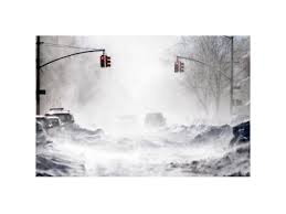
…BLIZZARD WARNING IN EFFECT FROM 11 PM THIS EVENING TO 8 PM EDT TUESDAY…

* WHAT…Blizzard conditions expected. Winds gusting as high as 65
mph will cause whiteout conditions in blowing snow. Significant
drifting of the snow is likely. Total snow accumulations of 10
to 18 inches with localized 20 inch amounts possible.

* WHERE…Coastal Essex County, Plymouth County, Cape Cod and
Marthas Vineyard.

* WHEN…From 11 PM this evening to 8 PM EDT Tuesday.

* ADDITIONAL DETAILS…Travel will be very dangerous with 1 to 3
inch per hour snowfall rates at times and significantly impact
the morning commute. The Tuesday afternoon commute is also
expected to be impacted. Wet snow and strong winds will result
in some power outages and tree damage.

HIGH WIND WARNING

…HIGH WIND WARNING IN EFFECT FROM 1 PM WEDNESDAY TO 1 AM THURSDAY…

The National Weather Service in Taunton has issued a High Wind
Warning, which is in effect from 1 PM Wednesday, March 7  to 1 AM Thursday, March 8.

* Location…Eastern Massachusetts from Plymouth County to Cape
Cod and the Islands.

* Winds…East 20 to 30 mph with gusts up to 60 mph.

* Timing…Strongest winds Wednesday afternoon and evening.

* Impacts…Damage to trees, power lines, and property are
possible with winds of this magnitude. Power outages are likely.

PRECAUTIONARY/PREPAREDNESS ACTIONS…

A High Wind Warning is issued when sustained winds of 40 mph are
expected for at least one hour, with gusts of 58 mph or greater
at any time. Take action to secure loose outdoor objects.


Emergency Shelter Opens Today at 5pm

CLOSED at 4pm Sunday.

The Town of Barsnatble’s Emergency Shelter will be opening at 5pm today Saturday March 3, 2018. The Shelter is located at the Barnstable Intermediate School, 895 Falmouth Road (Route 28), Hyannis. It is a pet friendly shelter.

As the storm continues to pull away from the region, the Barnstable Police have dedicated all resources to addressing the needs of the community. Several roadways have been affected by flooding, tree and limb debris, and severed or low hanging utility wires. The following road closures are in effect during clean-up efforts, and as flood waters subside.
· Rte 6A at the Sandwich Town Line
· Rte. 6A at High St.
· Rte 6A at Millway
· Millway and Commerce Rd.
· Freezer Rd.
· Rte. 6A at Keveney
· Bragg’s Lane
· Main St. Cotuit at Screecham Rd.
· 1029 Ostervile West Barnstable Rd.
· Osterville West Barnstable Rd. from Race Ln. to Rte. 149
· Old Shore Rd. Cotuit
· Flint St. between Rte. 149 and Calvin Hamblin Way
As reported by Eversource earlier today, extra tree and line crews have been dispatched to the most needed areas, and a significant impact on power restoration efforts is anticipated throughout the day.
The Barnstable Police urge all citizens to use caution when utilizing public ways, and to remain a safe distance from flooded areas and downed utility wires.


WINTER WEATHER ADVISORY

5A6CC3D8-AE05-4CEC-A0AA-6DE591630FA3

…WINTER WEATHER ADVISORY IN EFFECT FROM 7 PM THIS EVENING TO 7 AM EST SUNDAY…

* WHAT…Snow expected. Plan on difficult travel conditions. Total
average snow accumulations of 2 to 4 inches are expected.
Locally higher amounts up to 7 inches possible across the upper
Cape.

* WHERE…Barnstable County.

* WHEN…From 7 PM this evening to 7 AM EST Sunday.

* ADDITIONAL DETAILS…Be prepared for reduced visibilities at
times. Untreated surfaces will be slippery.

PRECAUTIONARY/PREPAREDNESS ACTIONS…

A Winter Weather Advisory for snow means periods of snow will
cause primarily travel difficulties. Be prepared for snow covered
roads and limited visibilities, and use caution while driving.


Weather Forecast Here