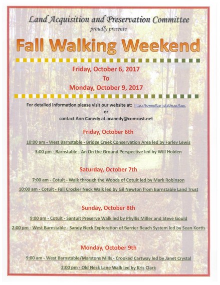
 Walking Weekend 2017 Details HERE

View HERE
Friday October 6 – Monday October 9
From Sandy Neck to Crocker Neck and Ponds in between
Take one of the many guided walks and learn more about the beautiful Town of Barnstable

For more Information Click Here

Cotuit Fire District Prudential Committee
Special Meeting
Tuesday September 26, , 5pm Freedom Hall
View Agenda HERE
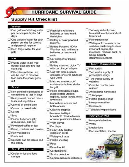 Don’t forget your Pets!




Hazardous Waste Collection Day
Saturday September 23 , 9-12
Barnstable Transfer Station
45 Flint St., Marstons Mills

Sunday September 24, 9am-noon Barnstable Sandy Neck Beach Park
Contact Donna Bragg 508-362-8300
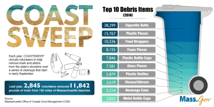
View Cape Cod Towns participating HERE
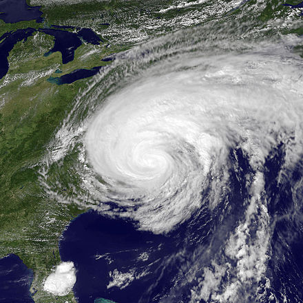
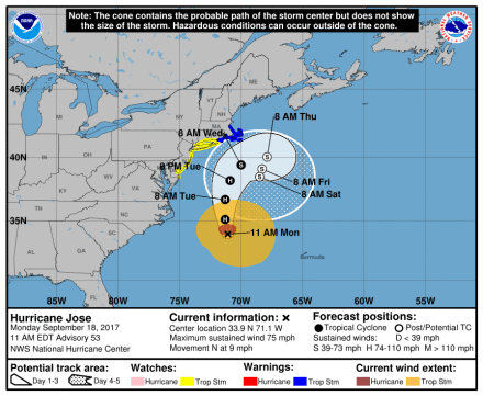
Update: September 18, 2017…TROPICAL STORM WARNING IN EFFECT..
* WIND
– LATEST LOCAL FORECAST: Below tropical storm force wind
– Peak Wind Forecast: 20-30 mph with gusts to 60 mph* STORM SURGE
– LATEST LOCAL FORECAST: Localized storm surge possible
– Peak Storm Surge Inundation: The potential for 1-3 feet
above ground somewhere within surge prone areas
– Window of concern: Begins early this afternoon– POTENTIAL IMPACTS: Limited
– Localized inundation with storm surge flooding mainly along immediate shorelines and in low-lying spots, or in areas farther inland near where higher surge waters move ashore.
– Sections of near-shore roads and parking lots become
overspread with surge water. Driving conditions dangerous
in places where surge water covers the road.
– Moderate beach erosion. Heavy surf also breaching dunes, mainly in usually vulnerable locations. Strong rip currents.
– Minor to locally moderate damage to marinas, docks,
boardwalks, and piers. A few small craft broken away from
moorings.* FLOODING RAIN
– LATEST LOCAL FORECAST:
– Peak Rainfall Amounts: 4-8 inches, with locally higher
amounts.– POTENTIAL IMPACTS: Limited
– Localized rainfall flooding may prompt a few evacuations.
– Rivers and tributaries may quickly rise with swifter
currents. Small streams, creeks, canals, arroyos, and
ditches may become swollen and overflow in spots.
– Flood waters can enter a few structures, especially in
usually vulnerable spots. A few places where rapid ponding
of water occurs at underpasses, low-lying spots, and poor
drainage areas. Several storm drains and retention ponds
become near-full and begin to overflow. Some brief road and bridge closures.* FOR MORE INFORMATION:
– http://weather.gov/boxAttention Town of Barnstable Mooring Permit Holders!
Please be advised of a potential strong wind/rain event next week 9/18/17.HERE is the link to the storm precautions web page. Please take all necessary precautions and if you have any questions contact the Harbormasters Office at 508-790-6273



You must be logged in to post a comment.